
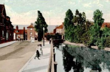
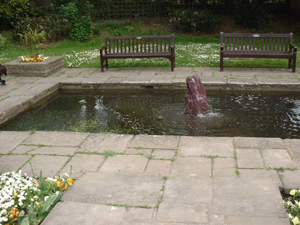
The Pool, Bayle Road in 1907. I was on The Bayle last trip, and although I couldn't get inside the little park area where the Bayle Pond is located as the gate was locked, I could see it, and it is a lot smaller these days than in this photo. (See pics further down)
|

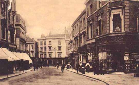
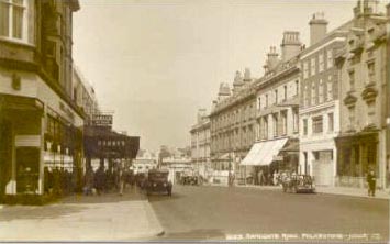
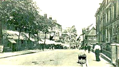
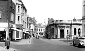
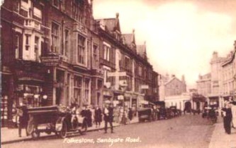
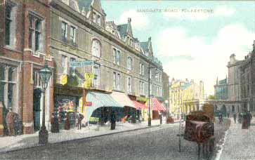
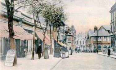
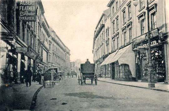
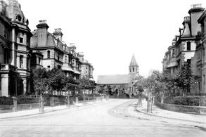
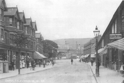
This 1907 photo shows the lower end of Sandgate Road. On the left is the Queen's Hotel, and ahead is of course the Town Hall, formerly known as the Guildhall - hence Guildhall Street - geddit?
The Queen's Hotel was at No. 2 Sandgate Road for many many years. I can't remember exactly when it came down, but do remember it being there. I know for sure it was still there in 1958. My Kelly's Directory also lists the Queen's Hotel Wine Vaults at No. 10. That must have been some wine collection if they needed to rent separate premises to house it!
|
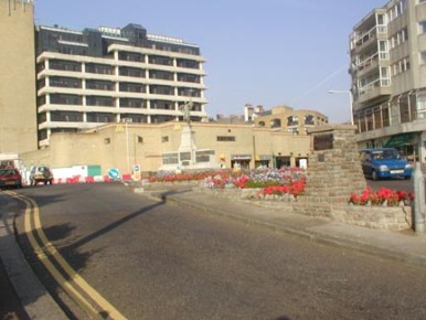
This is a modern photo of the Road of Remembrance, taken by Chris Keller. You can see that the war memorial is still there is all its glory, plus the cairn at the top of the road, and now it is flanked by beds of beautiful flowers. At the top of the hill you can just make out the war memorial, and behind that is McDonalds.
|
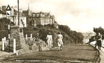
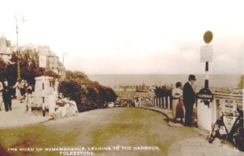

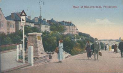
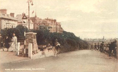
The Road of Remembrance, formerly called The Slope or Church Slope has been photographed many times over the years. Partially because of the memorial to our war heroes, and partially because of the wonderful view you have of the harbour and sea from the top of it. The pathway to the left leads to Albion Villas I believe, where Charles Dickens once lived.
|
1932
|
1920's
|
1950's
|
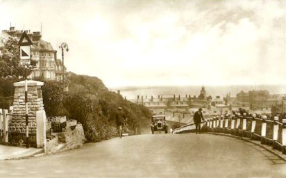
Ooh don't you feel for that poor old man? That is one steep hill to walk up!
There was no footpath then either.
|
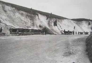
This was entitled 'Road Through the Downs' in 1962
|
Rendezvous Street in 1919. Boots the Chemist was on the corner of George Lane.
At the bottom you can see The Rose Hotel.
I think that was where Burton's Tailors was located when I lived there.
|
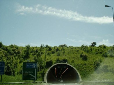
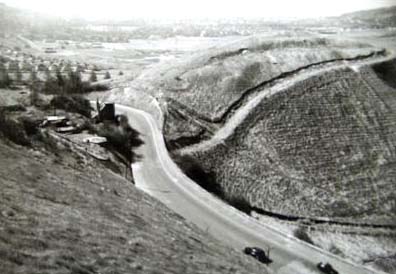
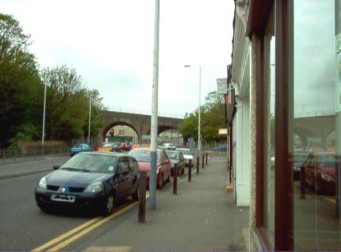
This photo was taken by Cliff Sherwood of the Virtual Tourist website - link on my links page. He calls this one the Round Hill Tunnel - is that what that hill is called? This tunnel has the road going through it which leads to Dover from the M20.
|


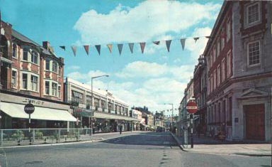
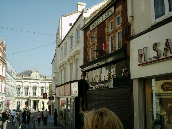
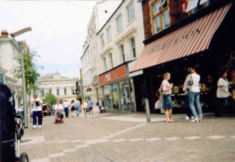
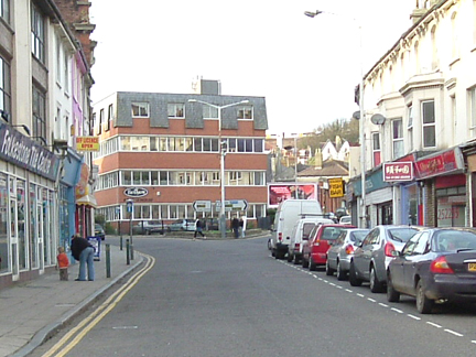
Nowadays, Sandgate Road is the main shopping area of the town. This photo was taken in 2003, and as you can see, the lower end of Sandgate Road had already been converted to a precinct. It is very nice to be able to wander from shop to shop without fear of being killed by passing traffic. At the end of the street is what used to be the Town Hall, but is now Waterstone's book shop. The two women on the right are chatting under the awning of O'clee & Son jewellers.
|
These both date from 1906, and could possibly have been taken on the same day, because it looks like the same woman wearing he white apron just out in the road doesn't it? The shop on the far left is Davis & Davis, house furnishers, who are advertising carpets on the billboard outside.
|
I don't know when this one was taken, but it was shot from a little further back from the two above, and you can see how residential it was in those days. Those houses on the right would be where W. H. Smith is today, and as you can see, neither Bobby's or Debenhams have been thought of yet.
Is that a ladder leaning up against that building? I have never seen such a long one if so. Surely it would bend in the middle if someone climbed it!.
|
1903
|
1985
|
1964
|
1920
|
1930's
|
1965
|
1965
|
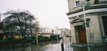
The modern photo above taken from the corner of West Terrace, and the picture on the left were both taken by Cliff Sherwood of the Folkestone Virtual Tourist site, link to which can be found on my Links page.
|
1906
|
1965
|
1913
|
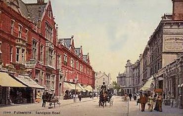
1907 & shows Cross's Library, Parson's Library & a french speaking hairdresser.
|
1965
|
1965
|
1907
|
We can see Maison Cree,Hairdressers,Parson's Library-with their bargain counter outside on the street, a shop selling Trunks and Valises that is also an agent for Goss, little crested china souvenirs of Folkestone that you can now buy on E-bay for a small fortune!
|
1923
|
Here we have the Stade again, towards the sands this time, and the photo was taken in the 50's or 60's. This is the way I remember it looking.
|
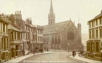
This is Dover Road, and the beautiful church was St. Michael's, alas now long gone.
|
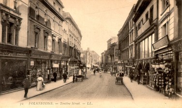
A lovely photo of Tontine Street, even showing the little presents that the horses had left behind in the road!
They didn't seem to have to drive on the left in those days either, I guess you could do as you liked as long as you didn't run into each other.
No speeding tickets either!
|
Tontine Street again in 1923 when some of the shops consisted of Timothy Whites Cash Chemists, Palmers, Gosnold Bros., Shepherds, & W.J. Franks.
|
1908
|
This is an 1890 photo of Trinity Crescent. The picture doesn't look as old as that does it?
|
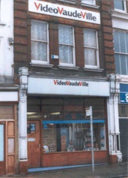
Before we leave Tontine Street, this photo was sent to me by David Bryceson, who also sent me the lovely old photo of Tontine Street heading page 1 of the Streets section. David owns Video VaudeVille, but I can't remember which number in Tontine Street he said he is located.
|
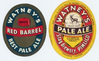
Why am I showing beer labels on the Streets page? Well, if you look closely at the pale ale label on the right, you will see that it is printed with J. T. Sams Ltd. 6 Tontine Street.
|
West Terrace in 1965
|
The widening of Dover Road in 1923
|

Home
|

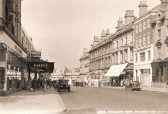
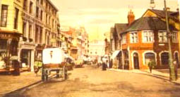
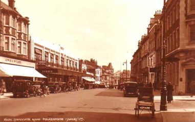
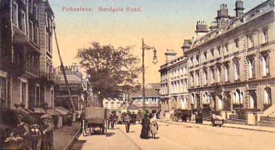
and here is Sandgate Road in 1907
|
Here are some Then & Now shots of Dover Road, showing the skew arches. I don't know the date of the one on the left, but there were more businesses and one heck of a lot less traffic in those days. I took the one on the right while I was waiting for my fish & chips to be cooked in the shop on the extreme right in 2005. The lady behind the wheel of that first car looked quite worried that I was taking her photo, because she was parked on double yellow lines! :-) (Don't worry love, I blurred your licence plate!)
|
Another Then & Now shot. On the left we have the Blackbull Road corner and Downs Road, where they are only just starting to build the houses. Now of course Downs Road is lined with homes on both sides of the street. I do believe that the building to the right of the old picture is the same as the one to the left of the Blackbull pub in the photo on the right, taken in 2005.
|
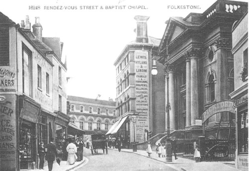
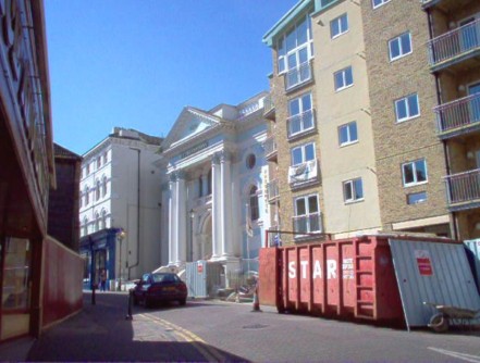
I didn't take the photo on the right from quite the same place as the photographer did on the left, but you can certainly compare the Baptist Church, or chapel as it was referred to in the older photo. Of course, these days that building belongs to Weatherspoons Restaurant, whereas when I was a child, we used to go downstairs to the left of the Pickfords sign to our Girls Life Brigade meetings. The building occupied by Lewis & Hyland next door to the church on the left looks to be still there on the right, but has lost its large chimney. As you can see, Rendezvous Street used to be a much busier area for shopping. It looks as if they are tearing down the flats on the right, I wonder what will go in there next?
|
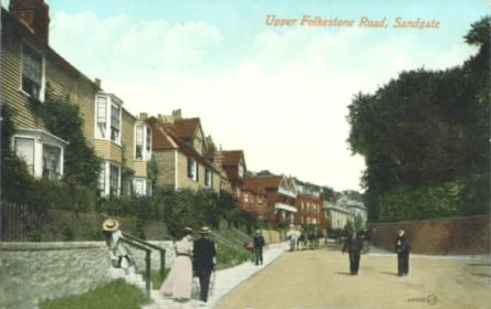
This lovely frozen in time photo was taken in 1909. They called it Upper Folkestone Road, but I believe it is what we always referred to as Sandgate Hill isn't it?
The houses look quite new, and relatively modern for the year.
|
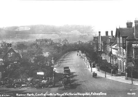
Here we have the corner of Cheriton Road and Radnor Park Road. In the distance at the bottom of Radnor Park you can see the Royal Victoria Hospital, and up on this first corner, it looks like a taxi rank doesn't it?
I don't know when the Central Hotel was built, but as you can see, it was around in the days of coaches and horses.
|
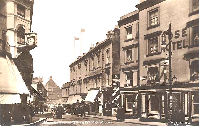
I really love this one, just look at the detail. On the right you can see The Rose Hotel, which was Burton's when I lived there, and later became Scruffy Murphy's. I am not sure what it is now. Next door to that, you can see B. Waldon Hall, Optician. This shop is now a Salvation Army charity shop.
|
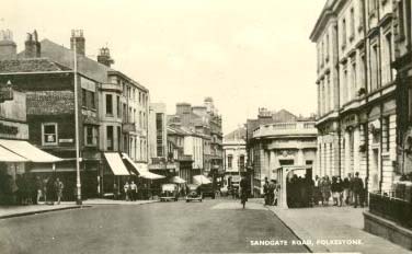
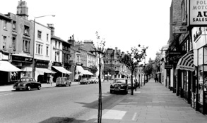
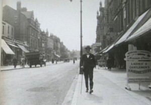
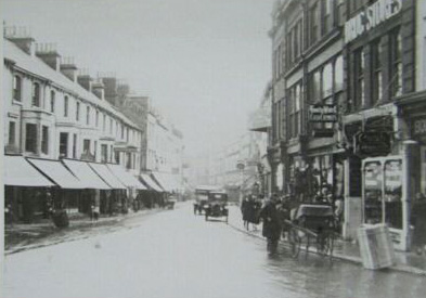
Another glimpse of Sandgate Road in 1949. I wonder if all those people were waiting for a bus?
|

After the page has loaded, if any photos remain blank, right click your mouse into the space and click 'Show Picture' and it should come in for you.
|

Dover Road in 2005, complete with Folkestone's official bird - the seagull!
|
Staying with the modern. This is Hill Road looking towards Dover Road in 2005. Actually what you are looking at is a little slip road, just off the main road, but it is still known as Hill Road.
|

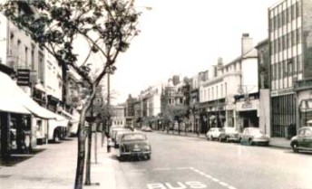
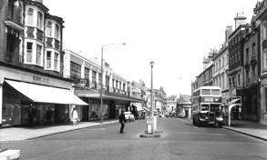
Sandgate Road again. I don't have a date for this one, but would guess it to be around the 1970's. On the left you can see it is still Bobbys. But you are no longer allowed to turn into that part of the street.
|
Don't forget - if some of the photos remain blank after the page has loaded, right click your mouse into the space, and click 'Show Picture'
|
I don't know the age of this one, but it doesn't look as if the pedestrians had a footpath then
|
This photo of Castle Hill Avenue was sent to me by Keith Meadows, I can't quite make out what that is on the corner there, it could be a street vendor, or some strange kind of bath chair. Maybe Keith knows? It's a great picture though isn't it? It dates from the 20's
|
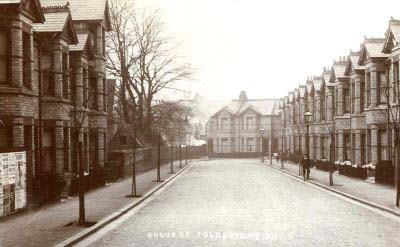
This is a 1907 photo of Grove Road, which runs off Dover Road near the skew arches.
|
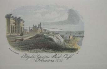
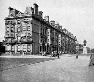
This is the way Pleydell Gardens, West Cliff looked in 1862
|
I took this one in 2005 when I was visiting a friend on St. Michael's Street. Lovely view of the sea from here.
|
I took this one from the junction of Bouverie Rd East and Bouverie Rd West, looking down Cheriton Gardens in 2005. I don't know who the fellow is!
|
This one was sent to me by Robbie Paramor. A friend of his took it from - I believe - the top of the multi-storey car park on Bouverie Rd East.
He also took some more from up there of the new development going in next to the bus station, but I will be adding those to the Buildings page.
|
If you have your own memories of Folkestone, be sure to share them with us by jotting them down in the book below
|
This page updated July 8, 2022
|
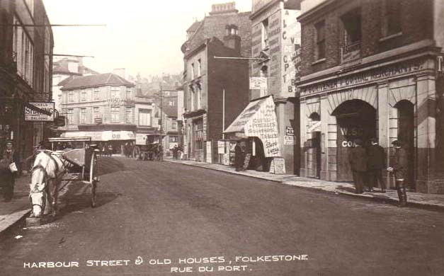
Below is a street that looks very different today. It is Harbour Street, which runs from the bottom of the High Street to the harbour. I think it is safe to say that all the buildings you see on the right and left are now gone.
|

Standing at the corner of Payers Park looking down Dover Road in 2005. Remember when this street was full of thriving businesses?
|
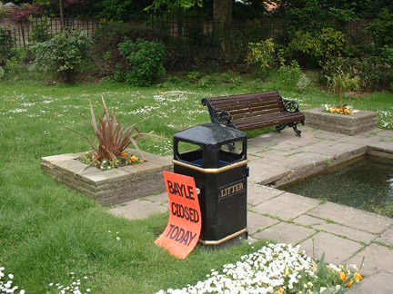
No, these are not streets, but as I showed you the Bayle Pond at the top of this page, I thought I would show you how it looked in 2005. I couldn't get inside the gate, as you see the notice on the right, but you can see how much smaller the pond is these days, and no swans on it.
Still, I am sure it is a pleasant place to sit on a nice day.
|

Recognise this street on the left? It is Cheriton Place between Sandgate Road and Bouverie Rd West in 2006.
|
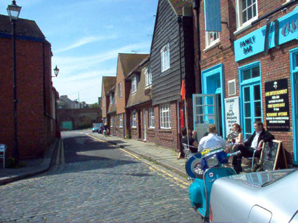
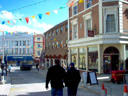
No prizes for guessing the one on the right. A 2005 photo of Rendezvous Street, this time with Mustangs at the bottom.
Just out of camera shot on the right is a wonderful sweet shop with all the sweets I remember from my childhood, you can buy them loose from jars too!
|
Still in 2005 we are now in the Stade area
You didn't see rubbish blowing around the streets in the older photos did you!
|
Now we are up on the Durlocks, you get some pretty amazing views of Folkestone from up here.
|
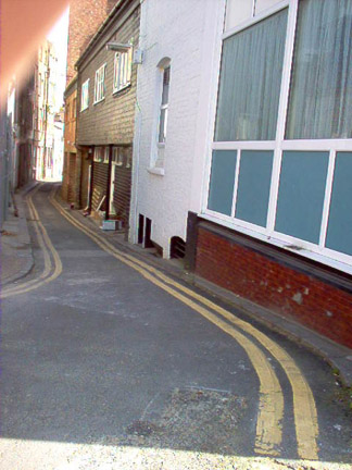
This alleyway is Mill Bay, it used to lead to the Folkestone Glassworks when I worked there, but I think it is closed now.
Mr. James Stanners owned it when I was there, and when I started, they were located in Tontine Street. I moved with them when they had their premises built in Mill Bay.
That was my first job when I left school, so long ago now! Would you believe he fired me when I got married, he didn't believe married women should work!
He certainly wouldn't get away with that one these days!
|
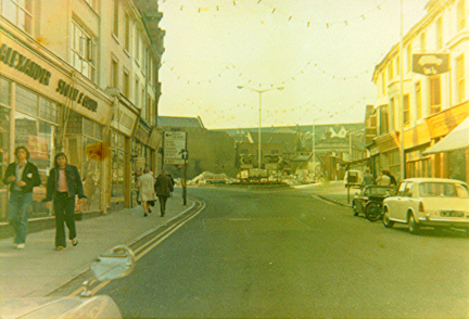
Oh look at these two photos of Tontine Street. Taken and sent to me by Chris Long of Folkestone. He took the one on the left around 1973/74 and the one on the right the other day in 2006. Chris says "In the old one you can see Strickland's scooter shop "where all us mods brought our Lambretta's from and there was a pet shop a few doors away, Over to the left I recall Guilding electricals where I have been told locals would get there Accumulators charged up for their Radio's. My Vauxhall Viva's front wing is in the shot bottom left I can't believe I had one of those"
You can't see it too well, but Stricklands is the shop on the right with the hanging sign, which shows a car on top and a scooter underneath. On the left, before you get to Guildings is Alexander Sloan, house furnishers, who occupied numbers 55 and 57 for many years. Now, as you can see in the photo on the right, it is occupied by Folkestone Tile Centre. I am not sure who is in the Stricklands location, but probably Chris can tell us. I don't know if Stricklands opened up after I left Folkestone in 1968, but the only Stricklands I remember was a bakery in Sandgate Road.
The biggest difference in the two photos above is the block of flats at the Dover Road junction. In the photo on the left, they had pulled down the Congregational Church, but hadn't built anything in its place yet. The other difference you will notice is the increase in parked cars in 2006. Also, I believe I am right in saying that although you can see double yellow lines in both of them. In the 70's, they were only on the left when you approached the corner, whereas in 2006 they run all the way down the street. If I am wrong about this, Chris, in his Vauxhall Viva was illegally parked! :-)
Thank you very much for sending these photos Chris, it is so much fun to compare them.
|
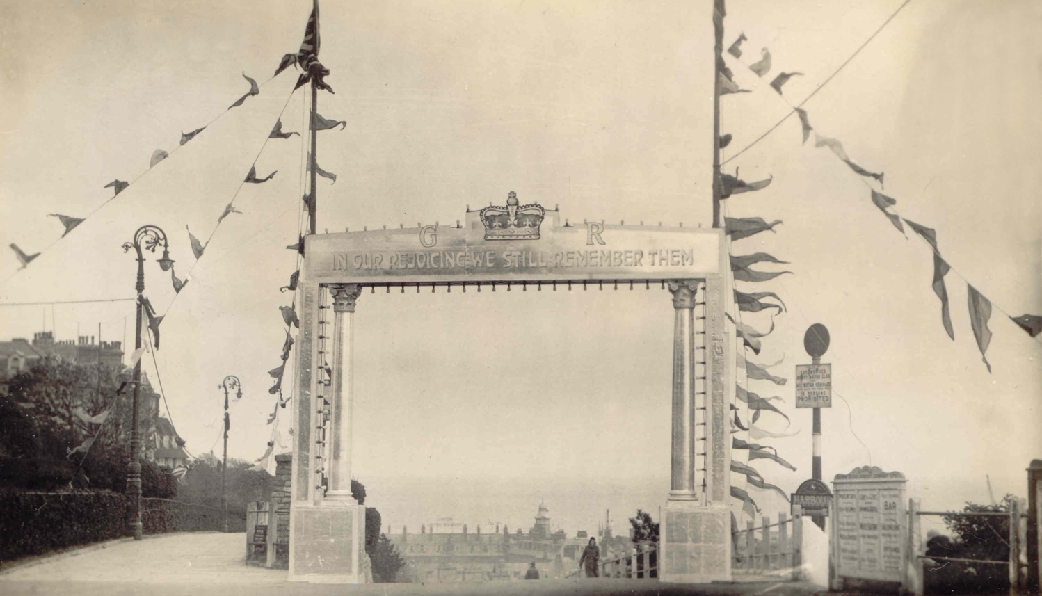
The arch on the right was erected June 27th, 2014 in memory of those who died during World War 1.
Step Short, who have been the organization behind it say It replaces an arch that stood at the top of the Road of Remembrance (which was renamed from The Slope Road after the war) during the 1920s and 1930s.
I beg to differ on this. The only arch I have come across is the one erected in 1935 (photo left) which was placed there to celebrate the Silver Jubilee of King George V. Now I am speculating here, but I suspect the citizens of Folkestone complained at the time, saying the Road of Remembrance was no place to put a celebratory arch, so as a compromise had the words added to the top "In our rejoicing we still remember them". The war had been over for 17 years by this time, so I really don't think it was intended to be primarily a memorial arch.
The Step Short project is sponsored by Kent County Council, Shepway District Council, the Roger De Haan Charitable Trust and several private donors as well as the Radnor Estate, the Don Hanson Charitable Foundation and EDF Energy.
The arch has cost £214,000 to build, plus it will have ongoing upkeep costs. Most of which will come from the public purse. I am not even going to talk about the new arch resembling half of the McDonald's logo.
I should add, I am now typing this paragraph a few years later than the above, and although there was a lot of opposition to this arch, people appear to have accepted it, and even quite like it.

This picture courtesy Shirley Owen
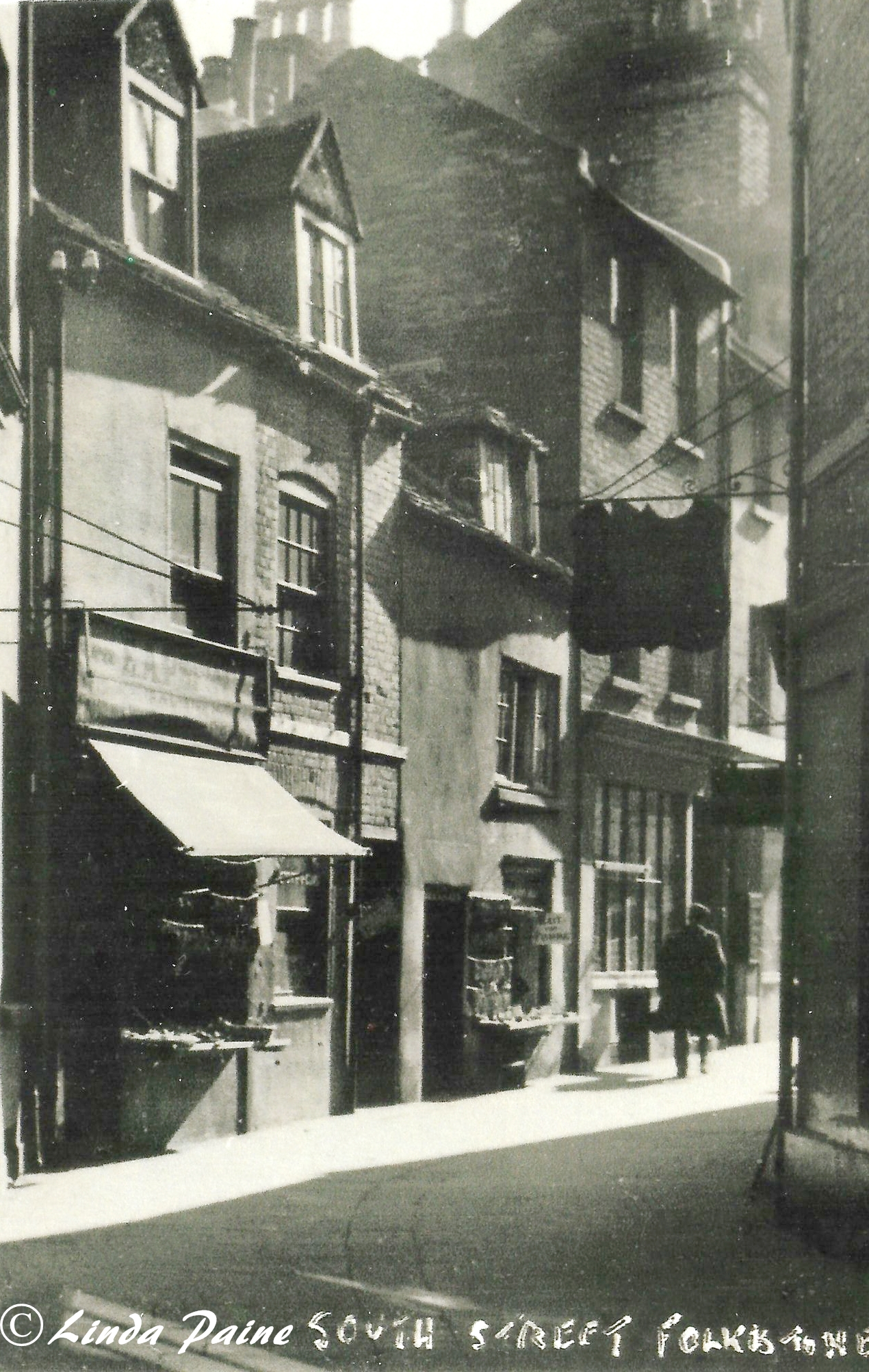
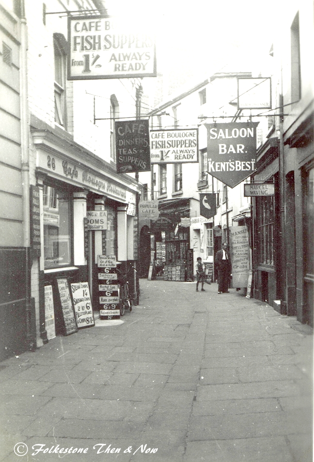
You will be forgiven if you are not sure where South Street is, because although I don't have a completely up to date photograph, the one on the right is the way it looked fairly recently. I think it should probably be downgraded now to an alley. Linda Paine kindly sent me the view on the left, not sure of the date, but would guess probably around 1910. The one in the centre was dated 1936, and rather than catering to the locals, it appears it is now definitely geared towards the tourist, especially French ones as the cafe is named Cafe Boulogne. But don't you wish you could still buy a fish supper for a shilling? (About 5p).
Ever since I remember, South Street has had the Princess Royal pub on the left, now closed for many years and the building has an uncertain future, and the three pubs on the right, The London & Paris on the corner, the Harbour Inn and the True Briton. In latter years the corner pub has been Gillespie's, and I believe it is in the process of transforming itself into a seafood restaurant and hotel. The True Briton has become the Harbour Inn, and I am not sure of what is to become of the old Harbour Inn in the middle. South Street is where you see a person cutting through to the Old High Street and Tontine Street.