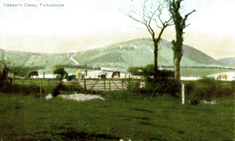
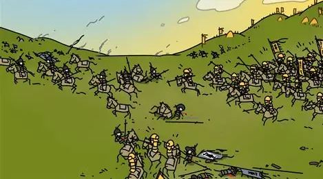
Caesar's Camp/Castle Hill Then
Caesar's Camp/Castle Hill Now

I have to admit right up front that I know very little about the hills around Folkestone. They are something that those who live there are inclined to take for granted. They are just there - always have been and always will be! So if you are an expert on them, you are probably going to cringe when you read some of the mistakes I am about to make on this page - but hopefully you will drop me a line and put me straight when I slip up.
Each hill has a name, and to be honest, I can never remember which one is which. Luckily most of the postcards say on them which they are.
The hills at the back of Folkestone form part of the North Downs, which is one of two areas of chalk downland in Southern England. The North and South Downs run parallel to each other, and would once have formed part of the same dome-shaped chalk outcrop. Erosion however has removed the chalk between the two ridges, forming an area called The Weald.
Anyway, let's take a look at some photos, some old and some new:
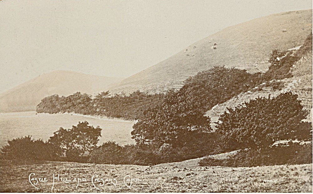

We start off with Caesar's Camp. Also known as Castle Hill, on the top of which was once Folkestone Castle.
This was a Norman castle on a natural mound which was in existence in the late 11th and 12th centuries. It was excavated in 1878 by Augustus Pitt Rivers and this has been claimed to be the first excavation of a medieval site in Britain using scientific methods.
Known locally as "Caesar's Camp", it is not actually Roman at all, but was probably constructed as early as 1095 and was certainly occupied for some time following the Norman invasion of 1066.
The earthworks now overlook the end of the M20 motorway and the entrance to the Channel Tunnel at Cheriton.
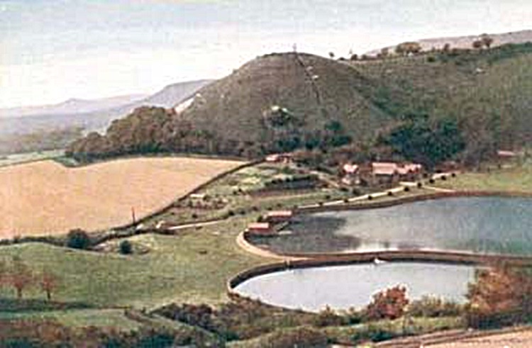
Above right is an old photograph of Castle Hill/ Caesar's Camp,showing the reservoir that used to supply Folkestone with its drinking water - the water supply for Folkestone and district has now been privatised, and to be honest, it has changed hands so many times, I am not sure who currently owns it. but it no longer gets its supply from the reservoir.
I have also read there is no evidence to suggest that Caesar ever camped on this hill, although he was in the area.
Something I am a little confused about though, if it was at one time named Castle Hill because of the timber castle, why, all the time I was growing up, was it called Caesar's Camp, when the Roman age was before the Normans invaded? I notice now though, that Castle Hill appears to be the name of choice, I believe more excavations were done and more evidence was found of the castle, so they probably decided it didn't make sense to call it Caesar's Camp when they found no evidence of him at all.
(History was never my best subject though!)
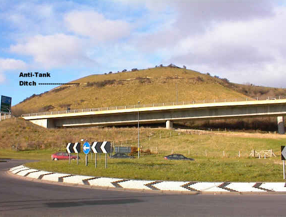
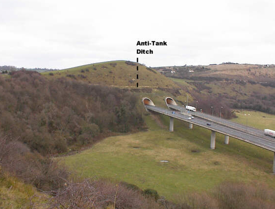
A modern photo showing the anti-tank ditch that was dug into Castle Hill, or Caesar's Camp during World War 2. I am a little confused however as to why these would have been necessary. Wouldn't it have been easier for invading tanks to scoot around the hills rather than climb over the top of them? I guess if they had people shooting at them from the top, that would give them a good reason to climb up there.
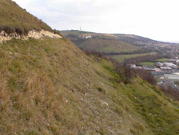
Here is a view of Folkestone taken from a hill, giving you a closeup view of the anti-tank ditch. Were they deeper when they were first dug I wonder? Or is that little scoop enough to tip a tank over?
Oh these tunnels in the Round Hill look very familiar to me! I hate to admit this, but I seem to inadvertently end up driving through this tunnel at least once each time I visit Folkestone.
The M20 is nearby, and I invariably turn onto this road when intending to turn onto the one that leads me to Hill Road, and as soon as I see the mouth of that tunnel looming towards me, the air is blue in my rented car I can tell you! Keep on this road, and you will end up in Dover, but I do manage to get turned around before I get that far!
An artist's depiction of Folkestone taken from a steel engraving. The only thing recognisable is the Parish Church of St. Mary & St. Eanswythe on the hill. I don't think I have ever seen an old painting of Folkestone without that church being in it somewhere!
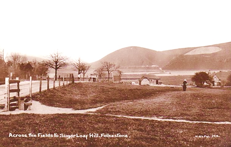
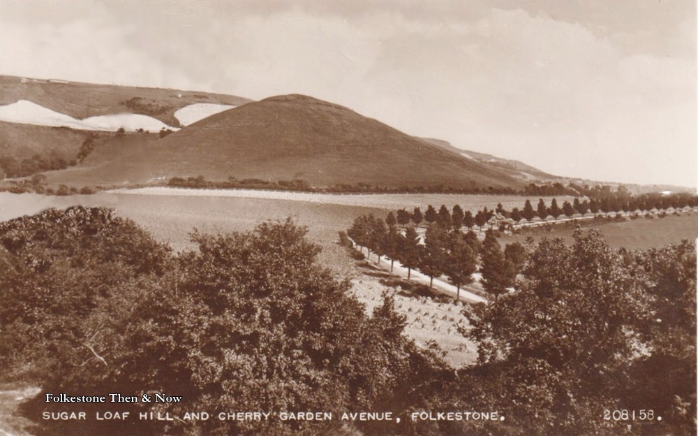
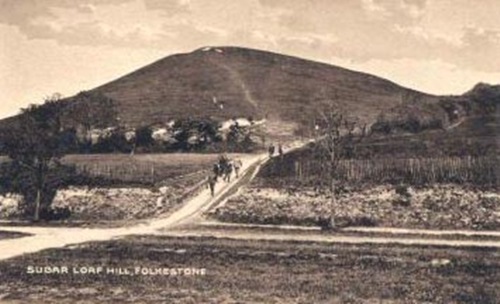
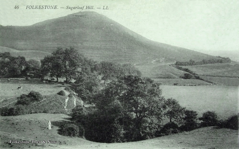
Both of these are of Sugar Loaf Hill. This one was named because that is the way our sugar used to arrive, in a big mound. I don't think I have ever heard of any other name for this hill. I wonder what the purpose was for those cut out pieces behind the hill in the picture below. Also below, you can see Cherry Garden Avenue. Were they cherry trees planted all along it? Or did it get its name from a nearby farm or something?

Page updated 5 April 2026
|
Trevor Butcher wrote to say that his theory is that they were probably originally L shaped, but have been eroded and filled in with shifts in the chalk. I suspect he is probably right.
Aha! I also received some answers to these questions!
Alan Taylor tells me the white cut-outs were chalk pits on the Canterbury Road. The chalk was used for lime burning, also used to ballast the sailing ships in the harbour after they had unloaded their cargoes of timber, ice or coal.
He also said that some of you may have heard of Foord Rd South (the bit from New Street to Dover Road) was once known as the 'Milky Way'. This was because the chalk got wet on a rainy day while being transported in carts to the harbour, and the water running down Foord Road was the colour of milk
In response to my question about Cherry trees etc. Alan said this:
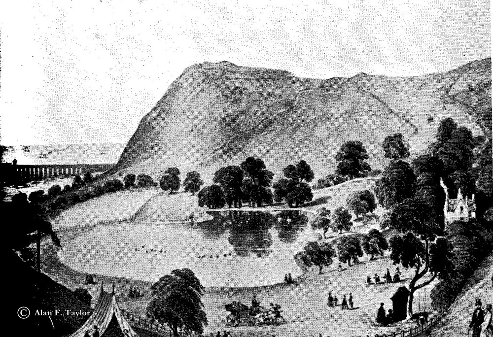
"They were not cherry trees, but elm trees, which were cut down after contracting Dutch Elm Disease. The road got its name from the Cherry Gardens which was where the Water Works Reservoirs are today. The Cherry Gardens was a place for recreation during the summer. There was a natural lake by the side of which there was a cottage where one could buy refreshments. About four o'clock onwards the ladies and gentlemen would sit down to an elegant dinner, after which a band played select airs and a merry dance on the green commenced with the lively air of Mrs. Macleod
And here we are, this was Cherry Gardens, and that must have been the cottage in the right of the picture
Thank you so much for all this Alan! I bet lots of us learned something new today!


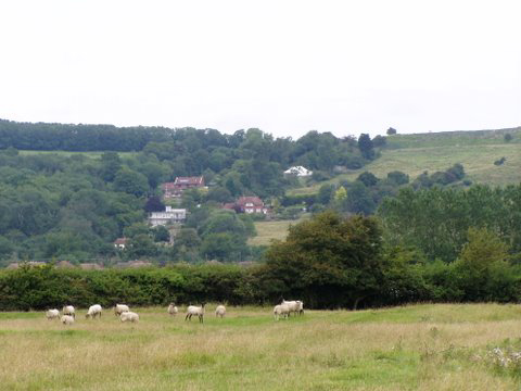
This nice photo was taken by George Hills showing a peaceful scene with Lympne Hill in the background
This one was called 'Crete Road and Rotten Row Skirting the hills' Rotten Row? That is a new one on me, I thought the only Rotten Row was in London! Can anyone shed any light on this?
If you have your own memories of the Hills, or of Folkestone, please share them with us by jotting them down in the guestbook below.


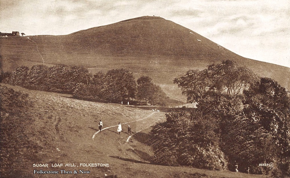
Three children playing at the foot of Sugar Loaf Hill. I don't have a date for it, but would guess it to be around 1912.
Now this is interesting. It looks like this photo was taken from roughly the same angle, and in the left, the road was marked out where the children were, and in this one, it has been cut out, giving better access to the hill. This would make sense if they were heading into WW1, and wanted to position troops onto the tops of hills.
I wonder what the woman was doing in this photo, maybe she had been tending to the cows over by the trees. I would never have survived those days, can you imagine doing chores like that in all weathers in a dress round your ankles and probably tight corsets underneath? I guess they were used to it, but trousers are far more practical. As for women riding horses sidesaddle, whose brainless idea was that?
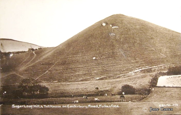
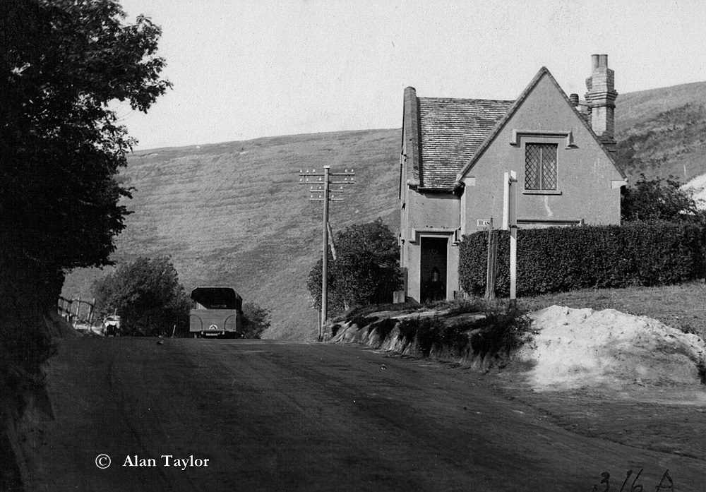
This one is called Sugar Loaf Hill and Toll House on Canterbury Road, and you can see the latter in the upper left side of the first photo above sent to me by Jane Carter. The mound of white you see behind it is the chalk pit. On the right we have a very nice photo of the Toll House sent by historian Alan Taylor who says this about it: "The Turnpike Cottage was on the bend in Canterbury Road, opposite Sugar Loaf Hill. Turnpikes were abolished in 1877 and afterwards this one was occupied by the Chalk Quarry Keeper, the chalk pit being next to it. Later on it was a tea rooms run by a lady called Granny May, and it was nicknamed 'Granny May's'. By the time of the 1949 Kelly's, the Chalk Pit was referred to as the Wingate Hill Quarries, and the cottage was called Wingate Cottage, owned by Maurice Roach. The building was demolished in 1963.
Thank you Alan and Jane.
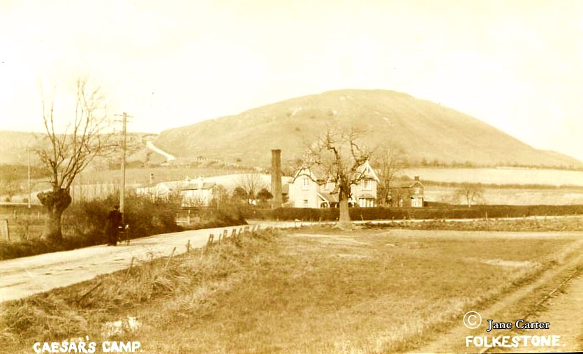
Back to Caesar's Camp/Castle Hill, and in another photo from Jane Carter, I think that chimney belonged to the kiln at the brickworks that used to be located in Tile Kiln Lane.
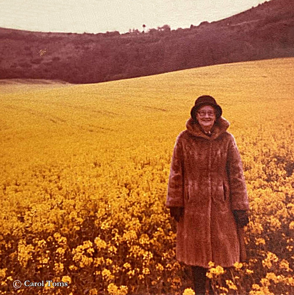
The lady in the photo on the right is there with permission from her daughter Carol Toms, who tells me it is her favourite photo of her mother, Joyce Toms. It was taken by her father, who wanted one of his lovely wife with a backdrop of that wonderful field of rape seed plants with the hills as a backdrop. She was standing just off the path in front of Castle Hill. All that wonderful yellow makes it look like a field of sunshine, but the fact that Joyce was wearing a fur coat, gloves and hat tells me it wasn't as warm as it looks that day.
This is the view from the top of Summerhouse Hill, at Beachborough, just the other side of Newington. It has quite a history. It was originally called Beachborough Hill, and was part of the huge Brockman Estate, first owned by William Brockman, who left it to his son James when he died in 1742. I won't go into all the history of Beachborough Manor as I have covered a lot of it on the Healthcare page, as the manor house was used as a hospital during the war.
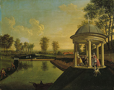
James spent a lot of money remodeling the grounds of his estate, digging out an ornamental pond that was called Temple Pond, and building what was referred to as a rotunda. He had an artist friend by the name of Edward Haytley, who painted some wonderful portraits of the finished work.
James remained a bachelor, and left his estate to his cousin Caroline's husband, the Reverend Ralph Drake, on the proviso he change his name to Drake-Brockman, which he legally did.
At some point, the Rotunda became known as the Summerhouse, and the Beachborough Hill was changed to Brockman's Mount, and then it was known as Summerhouse Hill, although many of the locals referred to it as Elephant Hill due to a scarring in the chalk hill that resembled an elephant, which is barely visible today.
.jpg)
Map of Beachborough Estate under the ownership of William Brockman.
.jpg)
The Brockman family and friends on the Beachborough Estate, now © National Gallery of Victoria, Melbourne, Australia. With permission
The Rotunda or Summerhouse had to be demolished at the start of WW1 as it was a target for bombs, and as I said earlier, the manor was being used as a hospital.
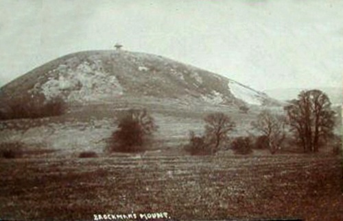
A 1900 image of Brockman's Mount showing the Rotunda or Summerhouse on top.
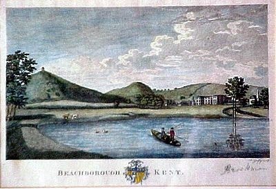
A small lithograph of the Beachborough Estate showing Brockman's Mount and Temple Pond.
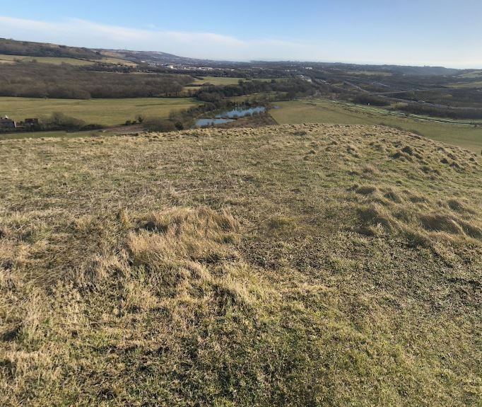
A modern photo of Summerhouse Hill, taken from the A20
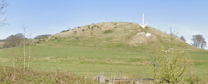
The arrow shows where the above mentioned elephant used to be,
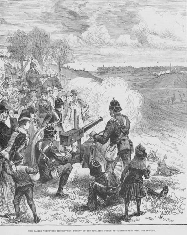
Before we leave Summerhouse Hill, this was taken from the Illustrated London News on Saturday April 12, 1890, and the clip was entitled "The Easter Volunteer Maneuvres. Defeat of the invading forces at Summerhouse Hill, Folkestone."
Now this is a coicidence - I just happen to be typing this on Easter Sunday, April 5, 2026, a hundred and thirty six years later!
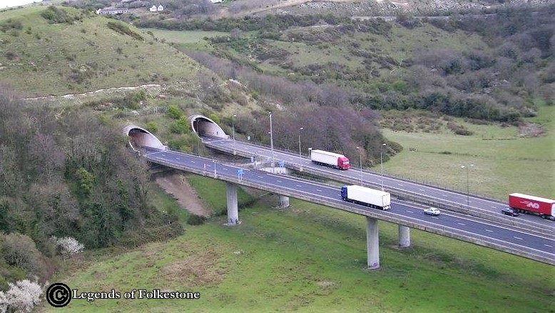
A really nice modern photo of the Round Hill tunnels that lead to and from Dover, you can see the size of the vehicles coming and going from the docks, as all the ferry services now sail from there.
Thank you Legends of Folkestone for this fabulous photo!
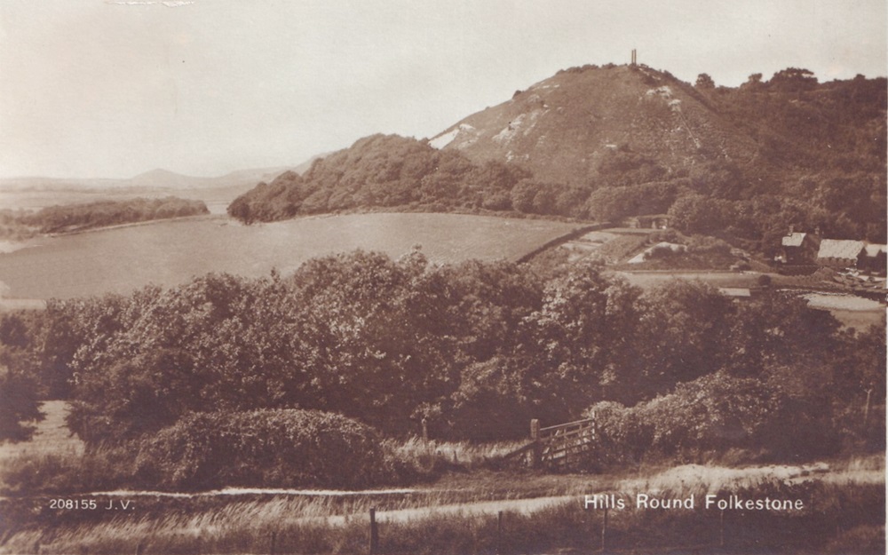
Now I need a bit of help with this old card, it is called Hills Round Folkestone. Does that mean the hills around Folkestone, or is that indeed Round Hill? I am hoping it is Round Hill, because it would be nice to have a photo of it before the tunnels were installed.
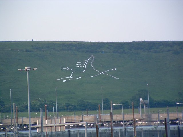
I am sure this one needs no introduction, it is the white horse on the Etchinghill Escarpment. On the left, taken from the Channel Tunnel area, and the right one was taken from Tesco's carpark in Cheriton. I have given this lovely addition to our town a page of its own, as it took a lot of effort by a lot of people to bring it about.. Click HERE to get the history on it.
Further to the anti-tank ditch debate, I received the following in an e-mail from Alan Hall, a fellow who did his growing up in Folkestone.
"The so-called "tank-traps" dug around the hills are a mis-nomer. The idea was for these to be defensive ditches in which the Home Guard / defending forces (in the event of an invasion), by using the height advantage, could fire mortars, rifles, machine-guns etc. at the enemy forces. Also, similar to the then-popular "pastime" of cutting down all iron railings on the pretence that the iron and steel was required for manufacturing munitions of warfare (very little actually got used this way); the scars on the hillsides served as a constant reminder to people that we were at war! Propaganda value & all that.
Incidentally, did you know that in medieval times, Sugar Loaf Hill was used as a place of execution for criminals? It was customary for said felons to be blindfolded, hand-cuffed and then pushed off the top of the hill - presumably, to their deaths!
As a child, I spent many happy hours wandering around these hills."
Thank you Alan, I certainly didn't know that. I wonder what happened to the criminals if they managed to roll to the bottom unharmed? The human race are very strange aren't they? There are a lot of easier ways of executing someone if that is what you have a mind to do, ways that are a lot less effort for everyone involved too!
Your theory on the anti-tank ditches certainly makes a lot more sense to me too! Although I have never seen one of those ditches big enough to hold men and their equipment, but didn't see one up close until many years after the war. Also possibly they were deliberately filled in when it was over. If they didn't use all the metal they collected for ammunition, I wonder what they did with it all? I am sure the people they took it from would have appreciated not having the expense of replacing it after the war, and would have been rather peeved to discover it had only been done for propaganda purposes to make people feel they were contributing to the cause.

The old card on the left was entitled White Horse Hill, Hawkinge. I am not sure if White Horse Hill originally went all the way up into the village of Hawkinge, but in 2025 I noticed that half way up the hill called White Horse Hill, it suddenly changed to Canterbury Road, yet it continued to go uphill. The name "White Horse Hill" in Hawkinge is derived from the street's historical significance and the presence of a White Horse inn. The White Horse inn, located in Uphill near South Hawkinge, (since incorporated into Hawkinge itself) is a public house that played a role in local history. The name "White Horse" is also associated with the White Horse Messuage, a newly built structure with stables that occupied the area in the late 18th century. The inn and the messuage highlight the street's connection to the local community and its historical events. A messuage was a dwelling house, outbuildings and land , and this one included stables.
White Horse Hill 2025
Another look at a couple of hills we have already seen above. This is Sugar Loaf Hill prior to tank ditches. That looks like a very sturdy house, but I bet it's not there any more.
A more modern one of Summerhouse Hill without the Rotunda on top. Is that Temple Pond? They don't keep it as well manicured around it as they did during the Brockman era, and they had to cut the grass with horse drawn equipment too!
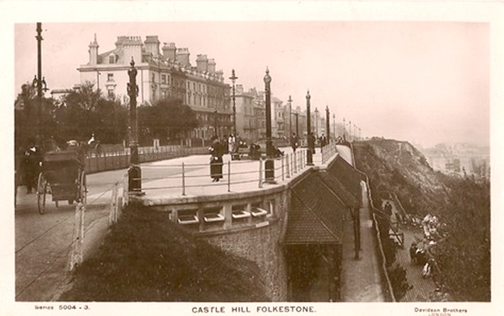
I do like to leave you with a conundrum at the end of a page. I know postcard manufacturers are notorious for getting titles wrong on cards, but I have seen the Leas referred to as Castle Hill several times on cards around this age - 1909. I have often wondered why Castle Hill Avenue was named thus as well, considering Castle Hill/Caesar's Camp was so far away, yet the road leads right into the Leas. Does anyone have an explanation for this? Was it once called Castle Hill because of the Castle that once was supposedly near St. Eanswythe's nunnery? Do we have proof of such a castle? I am sure I am not the first to query this.