
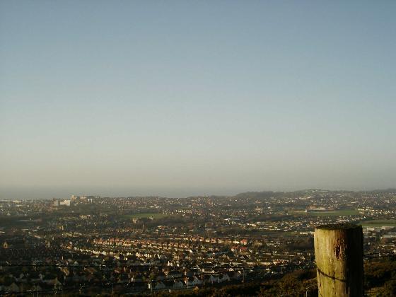
and views taken from high up!
|
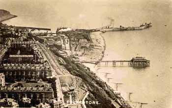

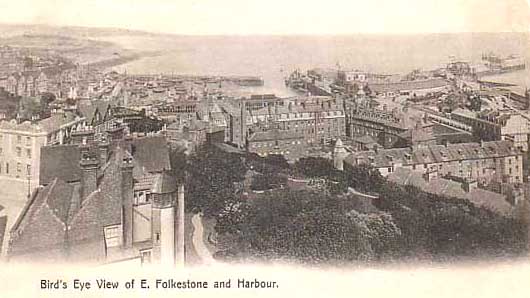
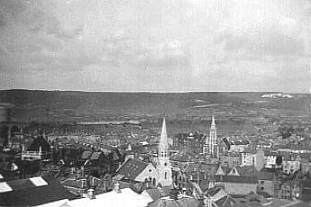
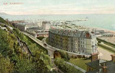
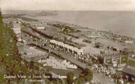
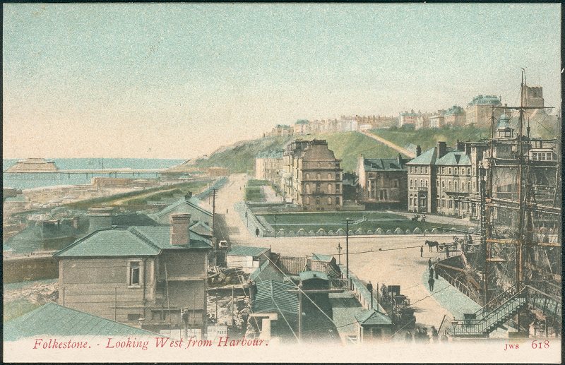
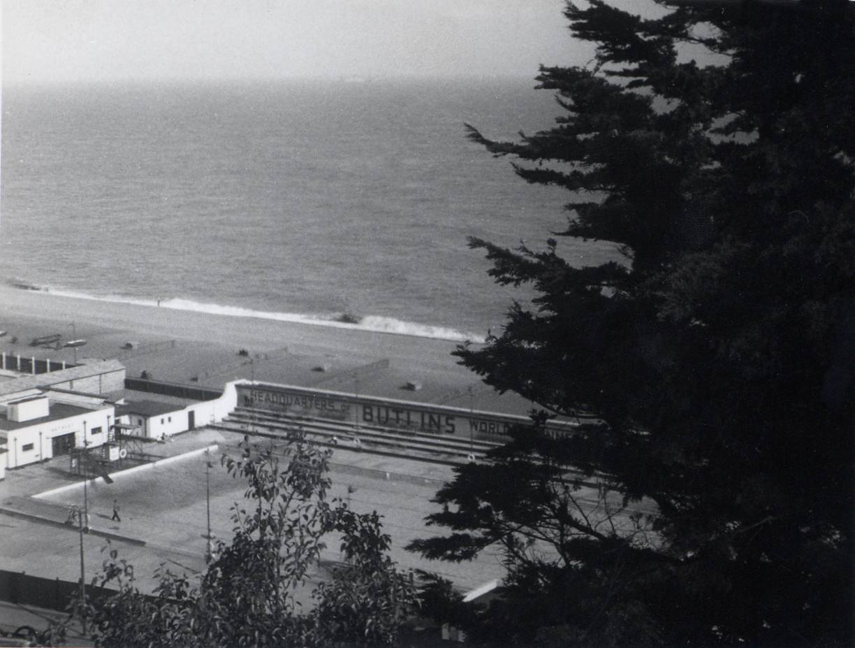
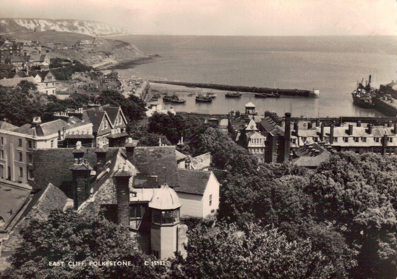
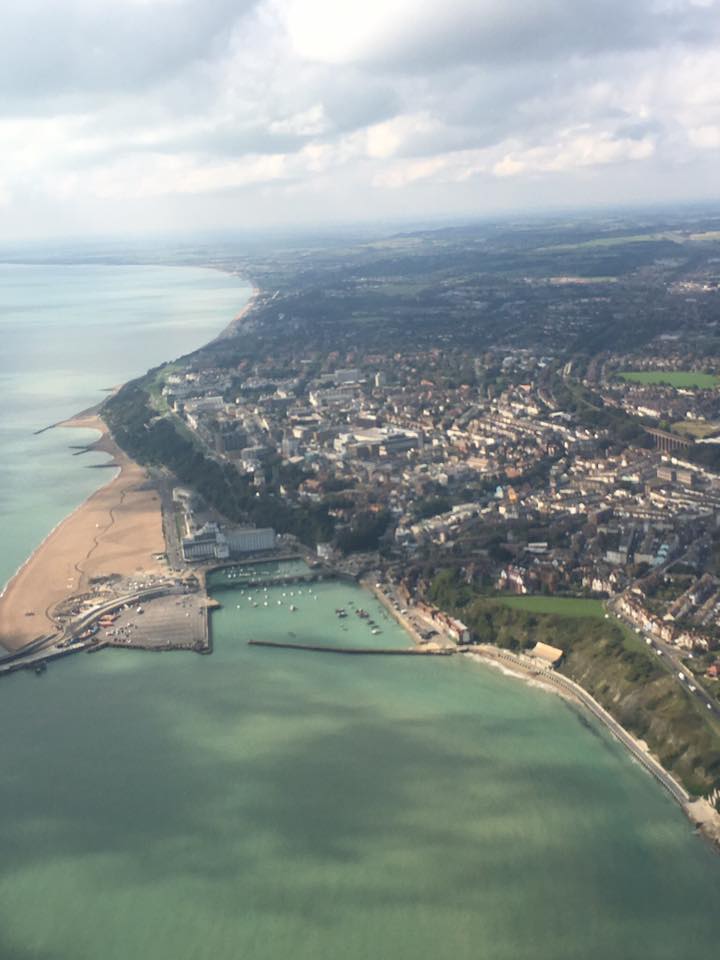
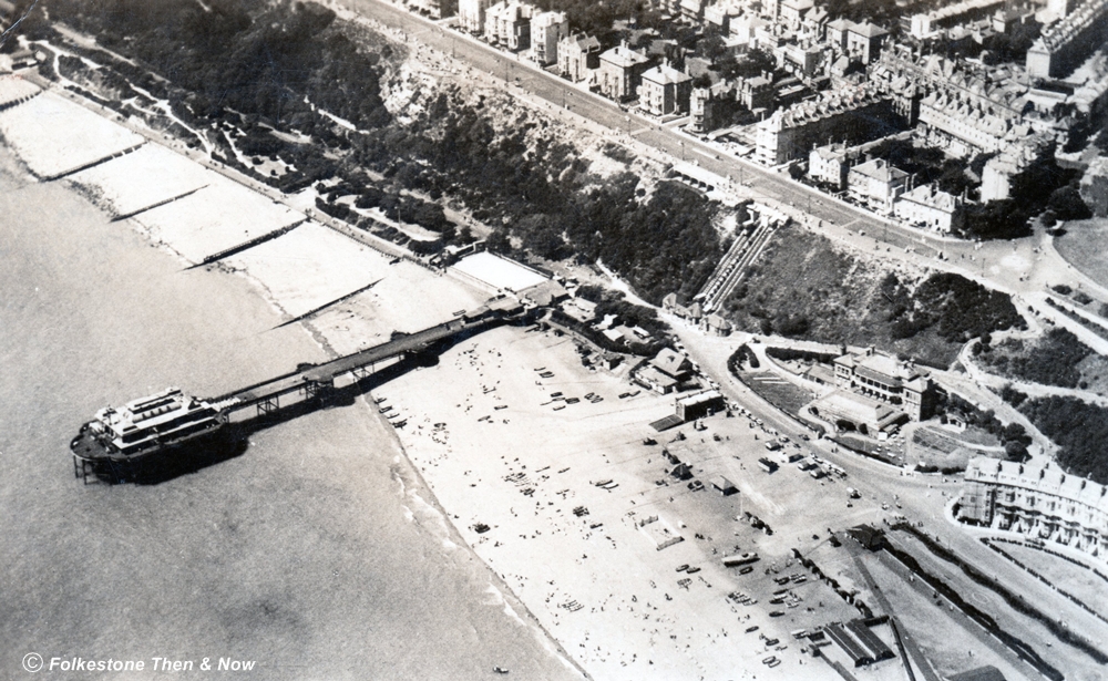
Folkestone has changed a lot over the years. I don't have a date for the photo on the left which was taken by something called an Airco Machine, but it shows the Victoria Pier, and in the background a busy harbour with a ferry berthed on the other side of the pier.
The main bathing area was the beach in the foreground, because the East Cliff Sands hadn't been cleared of rocks or developed.
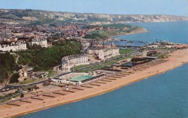
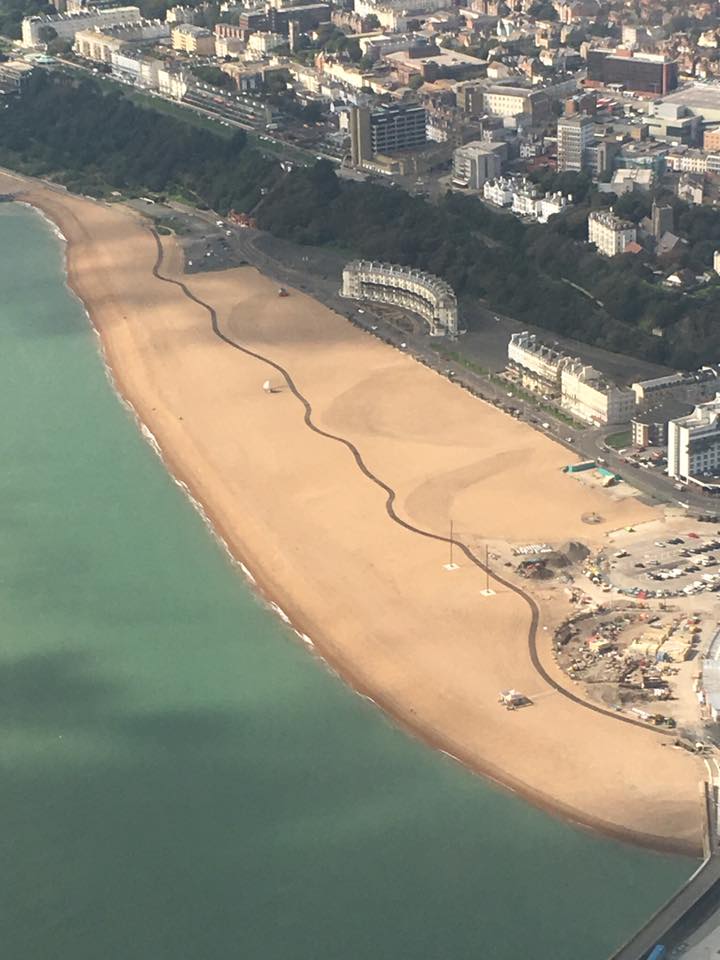
The photo on the right, sent to me by a Folkestone gentleman, tells a very different story. The pier in the background is deserted because the ferries are no longer running. The Victoria pier has burned down, and the west beaches, although still used, are not as popular as the East Cliff Sands for swimming, as they are shingle, which forms high ridges under the water, caused by the tides, making it unsafe for children and non-swimmers, as they can suddenly find themselves out of their depth.
In the old days, there was a stretch of sand near the Victoria Pier at low tide. I am not sure if they made a point of clearing this regularly to give the children a place to play, or whether it was naturally sandy there. As far as I know, it is not the case these days, and these beaches are all shingle.
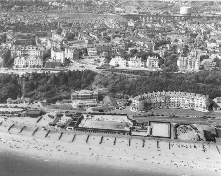
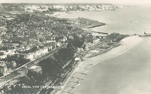
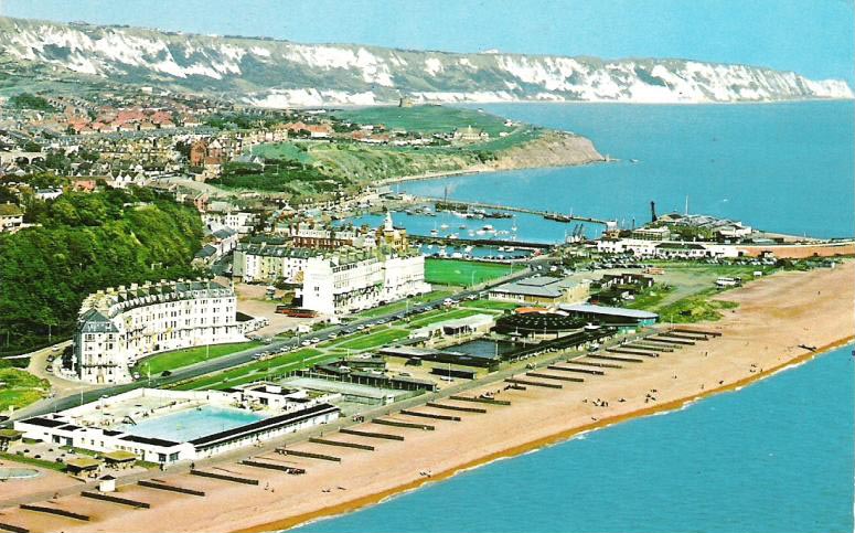
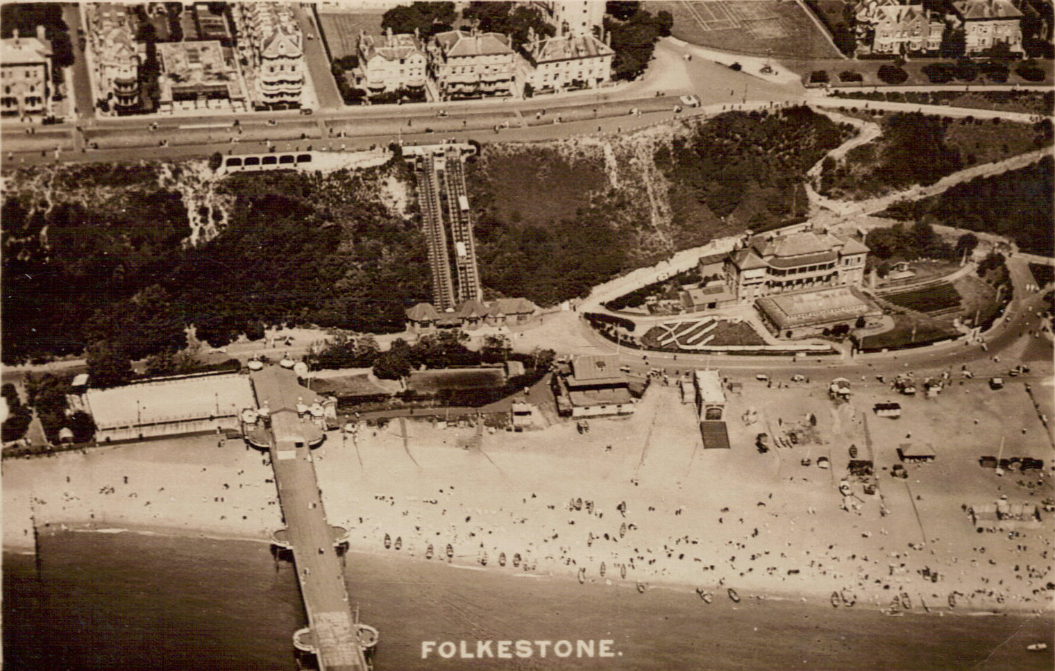
This view was taken a little later, in 1967. As you can see, the swimming pool was still there at that point, so was the Rotunda, but it didn't have any large rides back then.
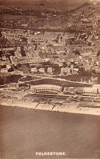
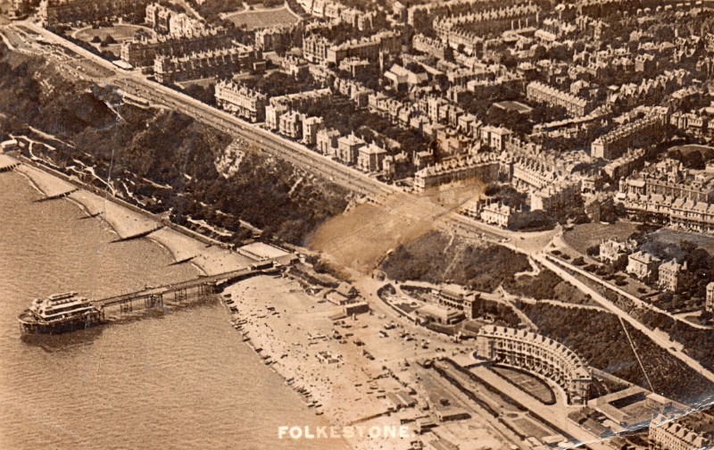
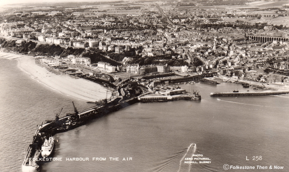
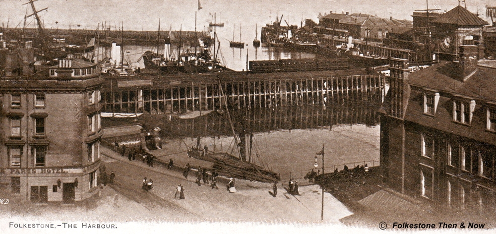
Now this is an old one. 1906 to be precise. It shows the harbour from an angle not often seen.
This one was taken in 1912.
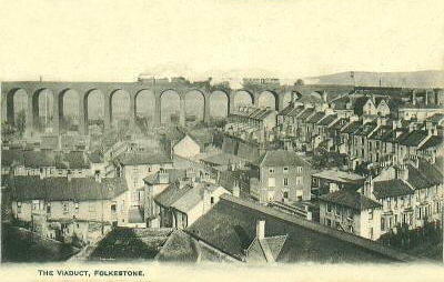
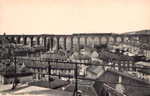
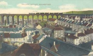
Do you know how many arches the viaduct has?
It has 19 - that is your piece of trivia for the day, now you can go out and dazzle somebody with your knowledge!
Stan Cascino sent me this one (his website is on my links page) It dates from 1975, but I don't see any major changes between this and the one above right do you?
Now here is a nice view, taken from somewhere up the Hills by Cliff Sherwood, of the Virtual Tourist website. (Found on my links page).
Thanks Cliff.
This was entitled 'Baker's Gap', can anybody enlighten me as to what exactly Baker's Gap is? Is it a cliff? or maybe another name for a part of the harbour? Got the answer - see right!
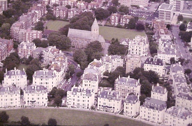
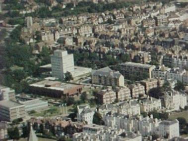
This wonderful modern aerial view of Clifton Crescent was sent to me by Brian Glover. Looking at these buildings all at once, you can see that they were probably designed by the same person, because they all look very similar don't they? In the centre is the Holy Trinity Church. Thanks Brian.
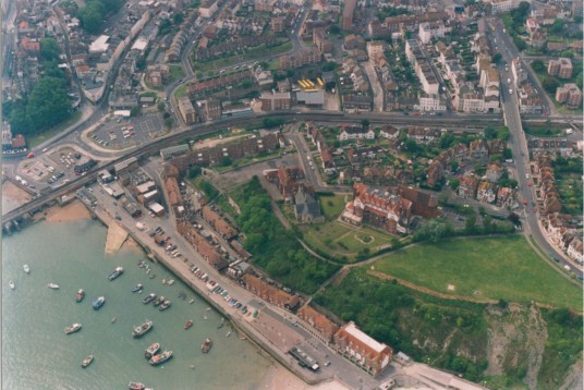
This fabulous shot was taken in 1990. Just look at the detail! You can of course see the harbour and Stade, then up on the Durlocks you can see what used to be the St. Andrews Nursing Home, but is now a block of flats, then to the left of that is St. Peter's Church.
Can anybody pick out their house? (Alan said he can! Did you know that he swims in the sea 365 days per year? Is that brave or insane?) :-)
This great photo, and the one further up taken in 1956 were sent to me by Karen Iverson. Thank you so much Karen!
This one was taken very high up wasn't it? You can even see a sprinkling of cloud below.
It was sent to me by Dave, who also sent me one of Hythe which I will show you later.
This 1931 photo was taken from the Queen's Hotel. The churches you see are the Grace Hill Methodist (formerly the Wesleyan Chapel, and St. Michael's on Dover Road. both now sadly demolished. (Thanks Paul for identifying them)
This one was courtesy of Alan Newble. It was taken by his father, Ernest F. Newble who took quite a few of Folkestone, especially if they involved steam engines, which was his first love. If you would like to see more of Alan's dad's photos, click here: http://www.newble.co.uk/rpics/dadspics.html
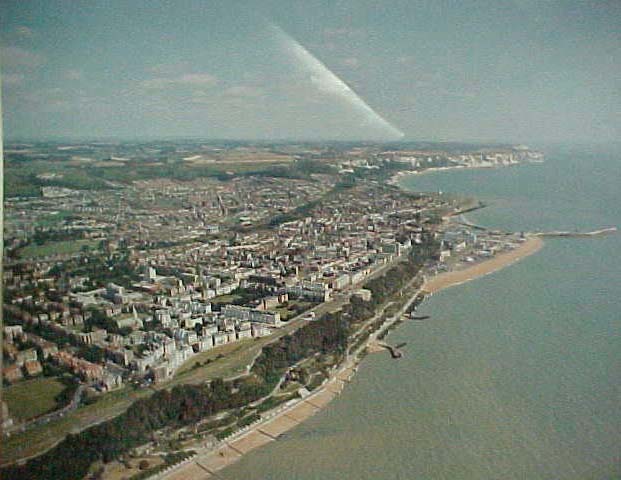
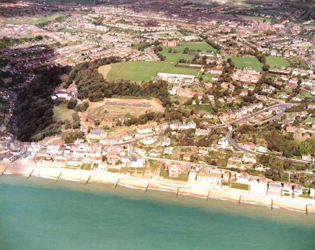
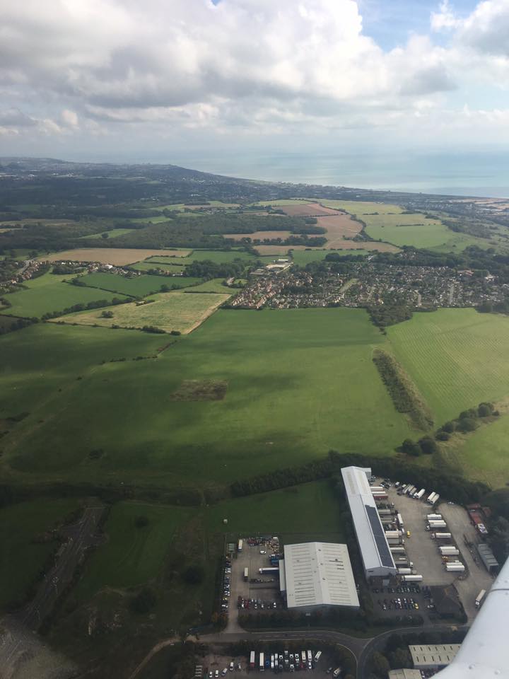
Another one sent by the same gentleman who sent the one at the top of the page. I believe the white building in the centre of the picture is the Shepway District Council offices.
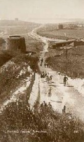
This is an old and interesting photo. It shows the first three of the Martello Towers that were built right down the coast.
When I first obtained this photo, I wasn't sure if all three were still standing, but
I checked out this wonderful Martello Tower website:
http://www.geograph.org.uk/article/Martello-Towers and found out that all three are indeed still standing. No. 1 is located on East Wear Bay, and has been converted into a residence, but I believe is standing empty at the moment. No. 2 is also a residence, on East Wear Bay, and is difficult to be seen due to shrubbery and trees around it. The one I am familiar with is No. 3, now used as an interpretive centre, and is owned by the Shepway District Council. There were 74 towers built originally, and around 9 of them were in Folkestone, many still standing, although derelict at Shorncliffe Camp.
Do check out that Martello website, it is fascinating!
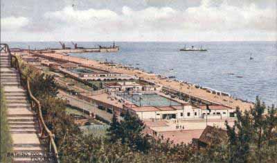
OK, so this wasn't taken from the air, but it was taken from the Leas. It is a 1908 picture of Marine Crescent. No Rotunda in this photo - but the space was being occupied by something, what exactly I don't know.
Are those steps still there that you can see leading down from the Leas? I don't ever remember seeing them.
|
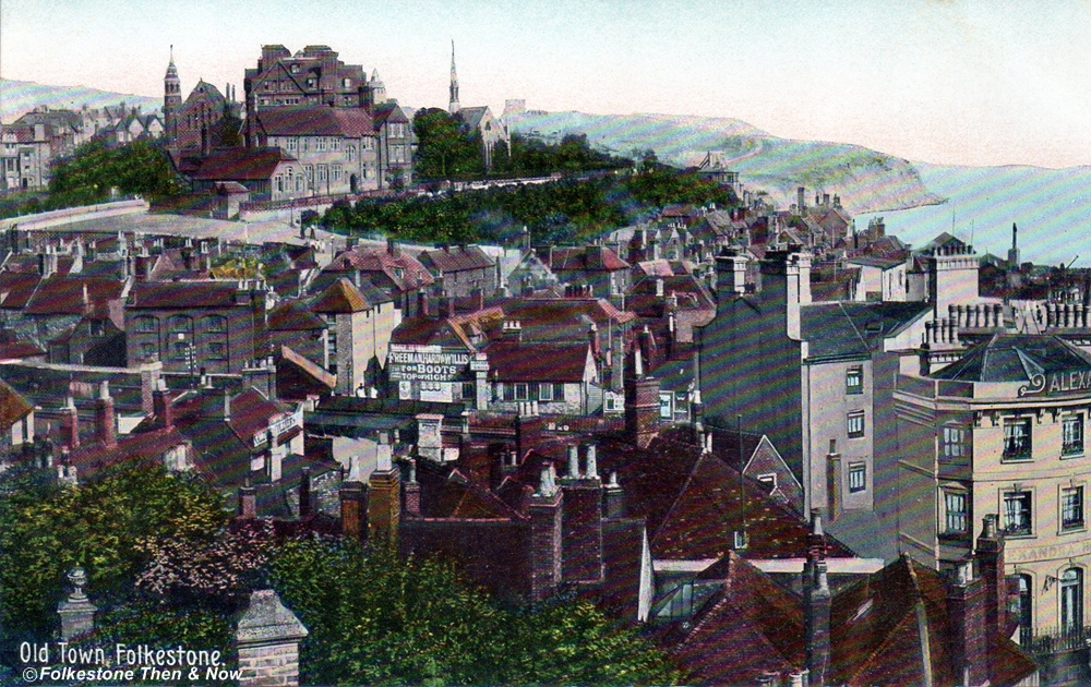
This is another very old one. It looks towards the East Cliff, and you can see the buildings up on the Durlocks. I can also make out signs for the Alexandra Hotel and Freeman, Hardy & Willis. Now I do remember the latter, they were a shoe shop!
|

Every once in a while, I come across a photograph that just cries out to be enlarged to see the detail. This is one of them! Click on it, and be patient, because it is 'very' large! But it is worth the wait, because you will see the Leas Shelter, people in turn of the century clothing, the pier, three - count them - three Fagg's bathing machines. The switchback railway, and in the bottom right corner, there is even a donkey on the beach!
Use your back button to come back here afterwards.
|
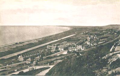
This is a 1914 photograph of Seabrook looking to the West. I think it is a little more built up these days.
|
Taken from the Leas, this picture shows Marine Crescent and Gardens. Immediately below, you can see the Seawater Swimming Baths. Can you see the lines full of either swiming costumes or towels? This one was taken in 1916.
|
There are those steps again! I just cannot for the life of me remember them being there. Can anybody tell me exactly when they were in existence? Hmm, Alan says they are still there, opposite the war memorial at the top of the Rd of Remembrance. I will have to take a look next time I go.
This photo shows the swimming pool below, and beyond that you can see the Rotunda, but there doesn't look to be much more than the Rotunda building itself, I can't see any rides.
|
Aha! This photo of the same place explains a question I had running through my mind. I was wondering why anyone would pay to swim in seawater, when there was a whole English Channel out there to choose from. But the advertisement on the roof of the baths explains it. The magic word is 'Tepid' Sea Water Swimming Baths. They warmed it up for the bathers! :-)
|
Two slightly different aerial shots of the viaduct, but both taken from approximately the same place as the one above. Possibly the Central Hotel, but I am not sure.
Do you remember how many arches the viaduct has?
|
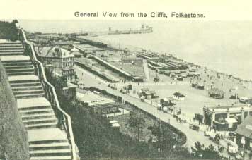
This general view from the cliffs was taken in 1927, and it looks like a hive of activity down there doesn't it?
Anybody know what those buildings were in the bottom right hand corner? Also, what those long structures were opposite Marine Crescent?
The left building is the Lifeboat House & the other one is the Rowing Club . Those long structures are rows of hedges each side of Marine Gardens...Alan
|


Home
|
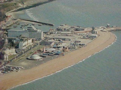
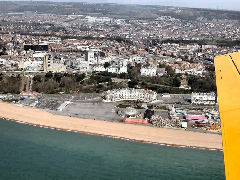
Here is a wonderful aerial shot sent to me by the Folkestone gentleman again. It shows the Rotunda, Marine Crescent, The Hotel Burstin, the Harbour and the East Cliff Sands.
Of course, the Rotunda is undergoing demolition, so this view will look drastically different in a few years, when they have put in all that they are planning for that site.
|
I was so thrilled to have received this aerial photograph by e-mail from a man who is living in what used to be the old Toll House (See more pictures of this house on its own page).
If I am not mistaken, I have the arrow pointing to his house in this picture.
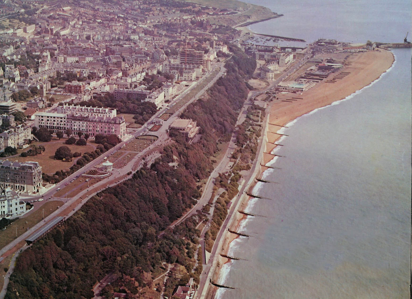
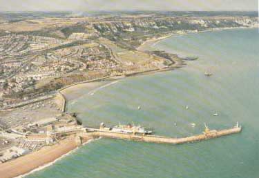
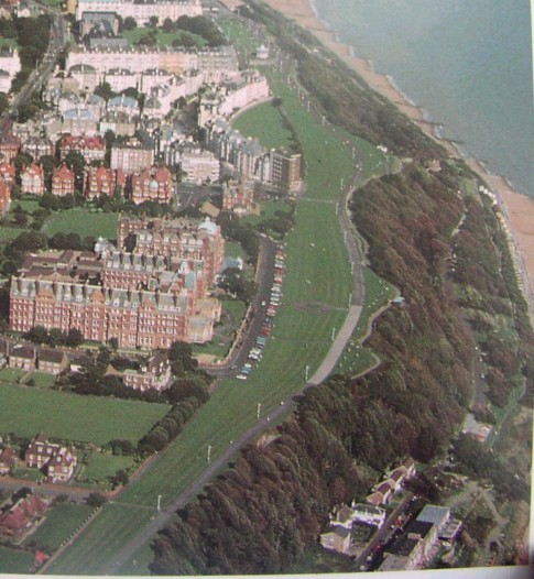
This is a lovely aerial view of the Leas as it is today, clearly showing The Crescent, the hotels, and the beach on the right.
Thank you so much for this picture, Gerry, it is a wonderful addition to the page.
|
This photo is especially for Bob Robson, who complained (tongue in cheek) about there not being any photos of Dallas Brett Crescent or Hill Road, then what do I get in my e-mail from the same gentleman who sent the one above, but this 1953 photo showing said Crescent and Road.
It shows Dallas Brett Crescent/Keyes Place(bottom right) the wide Grass Area is Hill road, part of Ingoldsby road, and the Crete Way Estate, the shops at Fleming way had not yet been built.
|
These two great shots were sent to me by Frank and Jane Sharpe of Dundee, Scotland, who took them while on holiday in Folkestone in 2004.
The first was taken from the Leas, and looks down upon the Amphitheatre on the Lower Sandgate Road, and also shows the men working on the new breakwater on the West Beach.
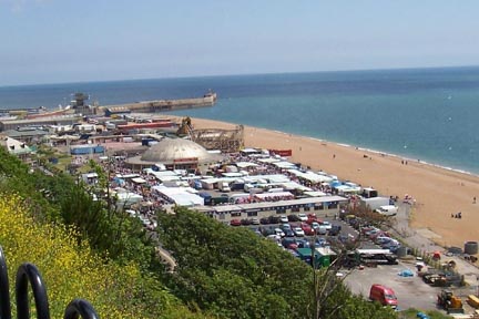
The second gives a great view of the Sunday market in full swing. Note the lack of parking spots!
As you can see, there is also not much left of the Rotunda.
Thanks very much you two! :-)
|
Brian obtained this photo from Simon at Channel Photography, who appear to have gone out of business. Simon originally gave me permission to have this photo here, but the link I had for them no longer works. If Simon is still around, or someone else now owns the copyright on this photo, and would like a new link added, please contact me.
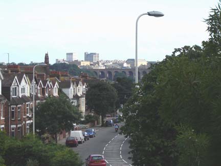
This great shot was taken by Malcolm Jeffery from the window of a toilet in a house in Joyes Road in July of 2005. We are looking down Canterbury Road, and you can see the viaduct, and beyond, behind the lampost is the Post Office at Bouverie Square.
|
Back to the past. This one was taken by an Airco 9 plane.
|
This aerial shot of The Leas was advertising the Avondale Hotel, but it didn't point out which it was.
|

This fabulous photograph was taken in the 1930's, and I certainly hope it didn't fall into the wrong hands at the end of that decade! It was of Lympne Airport. Just look at that detail.
|
This shot of Sandgate was sent to me by Don Benson, who told me he believes the owner of a house he used to visit - I think it might be the large one you can see top centre - had it commissioned.
|
Another one I just had to leave big enough for you to see the fabulous detail. It dates from 1938 and gives you a birds eye view of the harbour.
|
Page updated 20 Jan 2026
|
Alan Taylor of course had the answer to this one, here is what he said:
Baker's Gap is the area just past the sunny sands promenade.
It gets its name from the smuggling days when a preventative officer by the name of 'Baker' was shot & killed one night during a run. 'Run' the name used when contraband was being smuggled ashore.
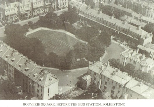
Stan Cascino sent me this really interesting photo of Bouverie Square, developed in 1862. The bus station wasn't built here until 1955. What a nice residential area that must have been once upon a time. Can you imagine the uproar when it was first announced they were going to fill it with diesel fumed buses? I do believe the row of houses bottom left are the only ones remaining today, and I do believe that Stan lives in the end one!
|
This general view from 1938 shows what a hive of activity it used to be. You can see the lifeboat station bottom right, the bathing establishment is the second building up on the left. I am not sure what the white unusual shaped building was on the corner.
|
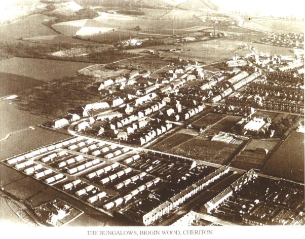
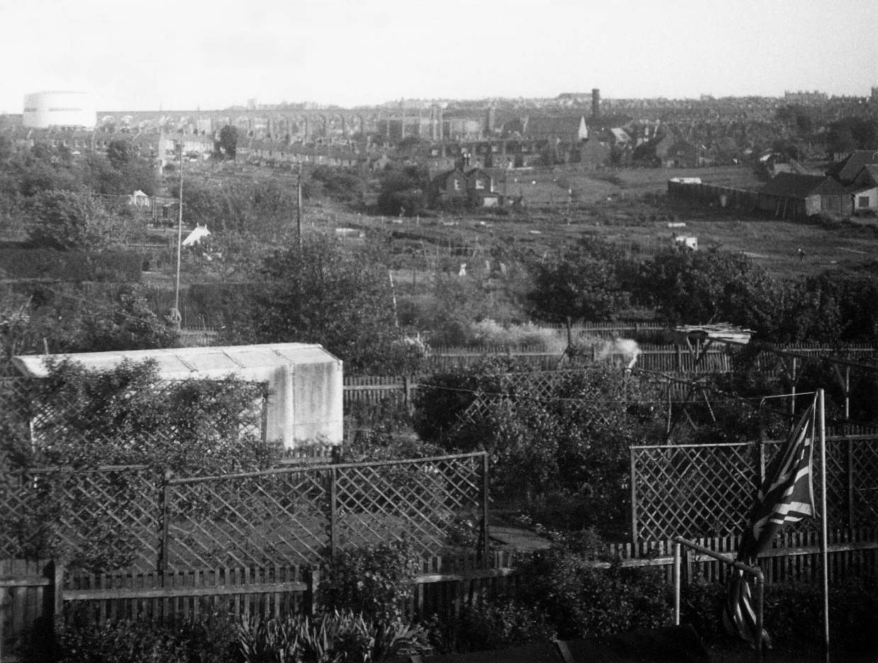
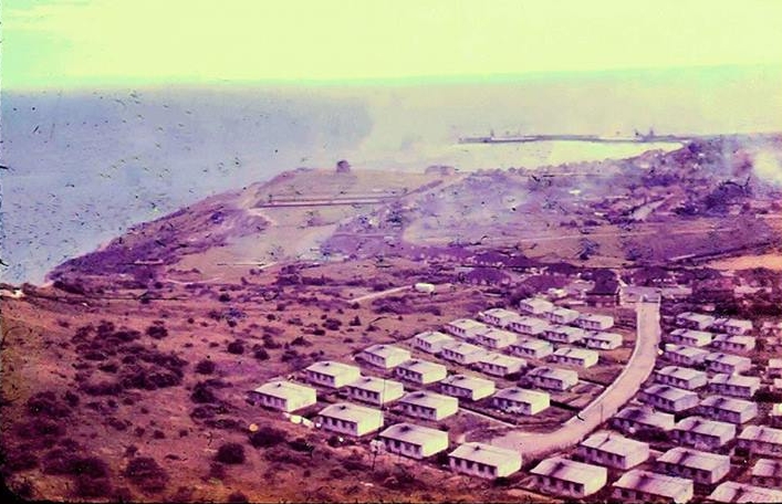
I should probably add this one to the Cheriton page as well. Who remembers the prefabs in Biggins Wood? They were hurriedly put up after the war, and were still there when I lived there. Are they there now?
My sincere thanks to Lisa & Tony in Folkestone for this scan!
|
I believe these photos were taken from the multi-storey car park. In the background, on the other side of the bus station in the photo above left, you can see the main post office. This has now closed, and the post office is now inside W. H. Smith in Sandgate Road. The last time I was there, I went to both the post office and W. H. Smith. They were both extremely busy, and I had to queue for quite a while in the post office. I wonder how long you have to wait to be served in W. H. Smith? I believe the post office building is still standing, but I am not sure what it is being used for. Anybody?
|
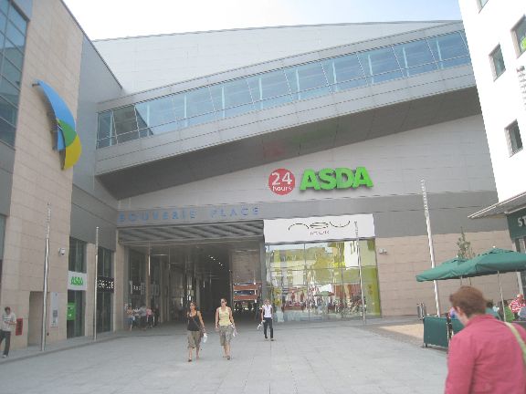
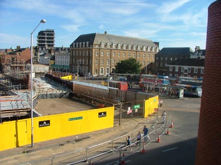
Well here it is finished. It is called Bouverie Place, and I went to take a look on my last visit. At the risk of upsetting a few people, I have to say I was disappointed. It was not what I was expecting at all. I thought it was going to be an enclosed shopping mall with lots and lots of shops and attractions. Instead, all the shops seem to have outside fronts, and there are precious few of them. The wind whistles through that alleyway between them, and the whole thing seems to have been set up for Asda alone. Quite apart from that, from the Bouverie Square side of the building, it looks to be the most ugly and unimaginative piece of architecture I have seen in a very long time, just a big block of concrete. They had the opportunity to build something really special for the town, something that would bring customers in from far and wide, and in my opinion they blew it!
Just my humble opinion of course. :-)
This is an art card I think. It gives you an idea of what went on when the collier boats pulled into the harbour, you can see the steps going up on the right.
The Victoria Pier is visible in the background, but no sign of the Rotunda or swimming pool as yet.
I was thrilled to find this one recently. It was taken from an Airco machine, and very clearly shows the Victoria Pier, the skating rink, the Lifeboat House and lots of other interesting looking huts and stuff dotted around the beach. In the background both lifts are working away. The Bathing Establishment is there, but I am not too sure what that building is in front of it.
I spent a lot of time looking at the roads leading up to the Leas on the right, and am pretty sure that first one isn't there now is it? Then there are two going away from the Leas, one should be the Road of Remembrance - or The Church Slope as it used to be called. Is the other one Priory Gardens? Those houses look too far set back to have access from that street. This has to be dated before the first world war, because the war memorial isn't on the Leas yet. You can see the fountain in place nearby, this was relocated to a little park on the corner of Wear Bay Road and Wear Bay Crescent when the memorial was erected.
It's a lovely interesting photograph isn't it? I was so happy to get it.
Had an e-mail from Nigel Armes in North Carolina, who spent a couple of hours in Folkestone recently and kindly sent me a photograph of the steps the way they look today. He guarantees they are still there because he walked the complete length of them - in both directions! A brave man indeed!
Nigel is a fantastic photographer, and I urge you to take a look at his work. He also has more photos of Folkestone on his site, but don't stop there, there is much more to see than that. Just look HERE.
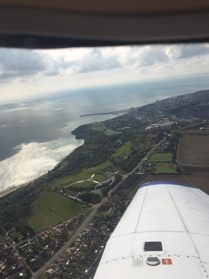
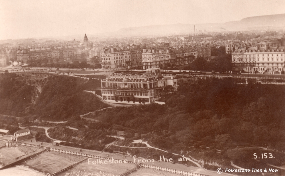
Another beautiful shot. This time we are looking across the Warren and East Cliff. The Burstin Hotel stands out, and is that Sandgate Castle in the distance?
No, you can't see Sandgate Castle from here. That would be No. 1 The Leas, a complex of flats....Alan
I knew this card was damaged when I bought it, but was hoping it was something that would clean off. However, someone had obviously dropped their tea or something on it many many years ago, and it has soaked right into the photograph, so gave up trying to remove it pretty quickly. It's unfortunate though because the stain is right over the area of the lifts. The card is dated 1926 and is from a son to his mother, who tells her that he has that day sent some dirty clothes home to her. I bet she was thrilled to hear that in those days of no washing machines!
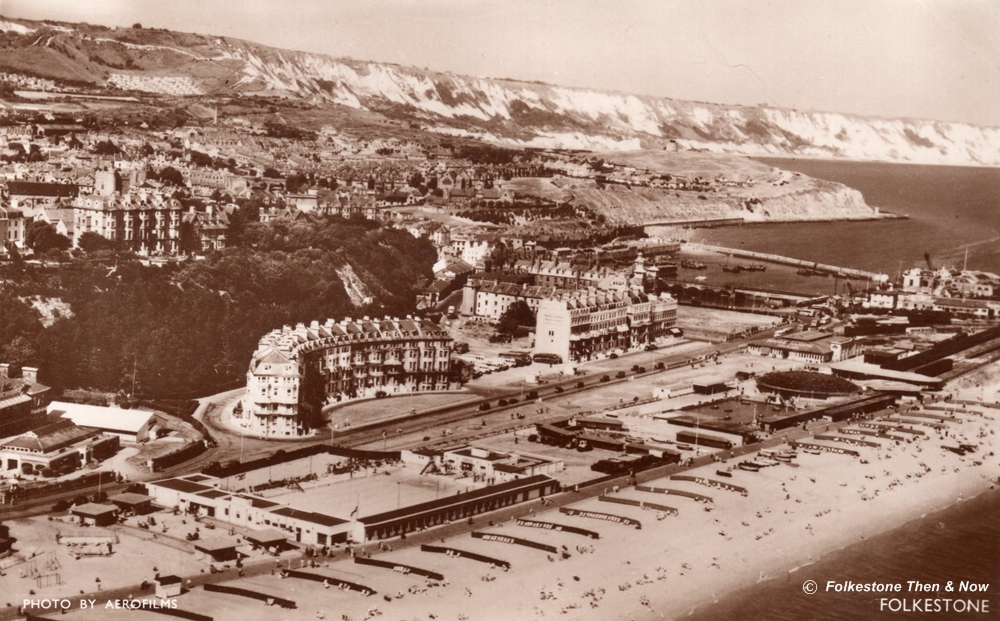
Isn't this a fabulous view? Taken in 1956, you can see the swimming pool, Marine Crescent and the Bathing Establishment. Up on the Leas, you can make out the War Memorial, then you can look right across Folkestone to the Gas Works on the upper right.
This one was also taken in the 50's and was sent to me by Carol Sage. It shows the swimming pool again.
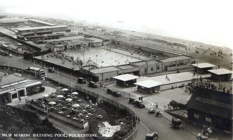
As this card is entitled 'New Marine Bathing Pool' (was that what it was originally called?) it must be dated around 1936, as that was when the pool was built.

I don't have a date for this one, but we can see that the Royal Pavilion Hotel is still there, and the ships were steam.
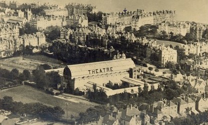
Here we have an aerial shot which shows the back side of the Pleasure Gardens Theatre.
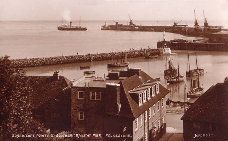
Copt Point, and the Southern Railway Pier.
This one is not so modern, we can tell not only because it is black & white, but also because the Royal Pavilion is still there, and a ferry is docked in the distance. I wonder what that round building is in the foreground? There must have been a wonderful panoramic view from inside there. Can anyone tell me if it is still there, and where it is/was located?
Paul Seward tells me it is indeed still there, attached to some flats on the corner of the Bayle and Priory Gardens. Lucky person who lives there! Found it! See further down the page...
CaroleSage.jpg)
Both the photo above and below were taken in the 1950's from 129 Downs Road. They were kindly sent to me by Carol Sage.
Another one from the 50's and sent by Carol Sage. This time we have the back of Marine Crescent, the boating pool and The Dome of the Rotunda. Not much there yet in the way of rides is there? Although you can see a little kiddie's roundabout.
I don't have a date for this one, but would guess it to be 50's or early 50's, but stand to be corrected.
This is Lympne Castle from above. I was christened in the church next door to the Castle, and have a nephew buried in the graveyard there. It's a beautiful peaceful place to go, and I do, every time I visit Folkestone.
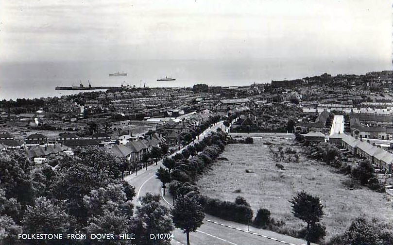
This shot from Dover Hill was taken in 1959.
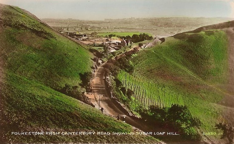
This one from Canterbury Road is obviously a lot older, quite apart from the fact that the women are wearing long dresses, and the photo is obviously hand tinted, look how much space there is in Folkestone!
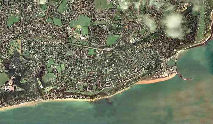
This wonderful aerial photograph was taken in 2004 and sent to me by Bob Gaylor. Isn't it breathtaking? You can see the Rotunda in the throes of being dismantled, then you can see right across Folkestone, past the viaduct and on to Caesar's Camp and Sugarloaf Hill. Thank you so much for sharing it with us Bob.
This one dates from approximately 1919. We can tell because the No. 1 Restcamp is still there on the harbours edge, right opposite the Pavilion Hotel. This was modified as a Grandstand that same year and moved to the the Folkestone Football Ground on Cheriton Road. The bandstand was still there in Marine Gardens at that time.

This wonderful shot was taken from the top of the Bouverie Place shopping centre by Paul Saunders. Thank you Paul, it's fabulous. If you click on it, you can see it enlarged along with a couple of others that are crying out to be seen in their full detail.
This aerial shot was taken in 1972 when there was lots to do down in the West Beach area.

Now I know you are going to want to see this one more closely, so click on it and you will see the Beach Street area when the Ark Cafe was still there on the right, and the Royal George on the left. The Channel Cafe was just on the other side of the railway line.
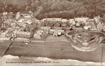
Another view of Sandgate, a lot older, and this time featuring the Castle. The outer walls that you can see are no longer there.
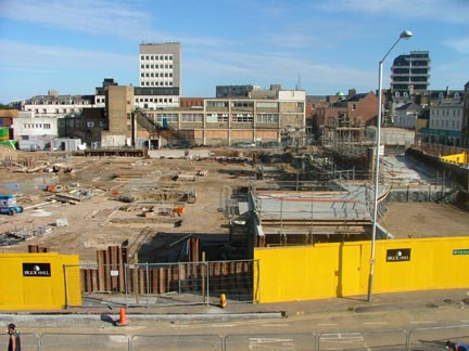
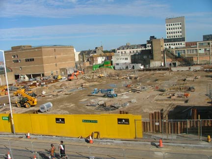
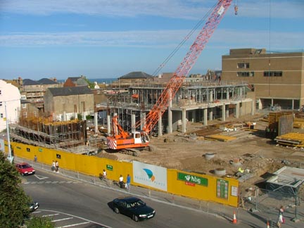
This photo and the following 4 show the Bouverie Place Shopping Centre in the process of being erected. It was due to be opened in November 2007, but I am not sure if it opened on time. These photos were taken by Anthony Hill and sent to me by Robbie Paramor. The shopping centre is right next to the bus station, and takes up the whole block including most of where Alexandra Gardens used to be. Thank you for allowing me to post them here Anthony!

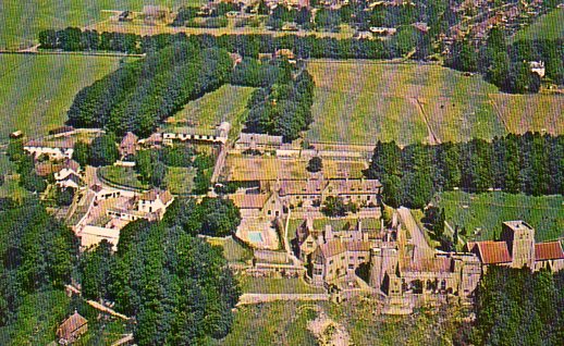
This is Holy Well School in Park Farm. Now I know all you ex-pupils will want to take a closer look at this, so just click on it to see an enlarged version. Use your back button to come back here afterwards.
About those steps. Paul Seward tells me that there actually used to be two sets of steps, one set that is still there and runs down from the Leas opposite the War Memorial, but there used to be another set which ran down to the Leas Shelter. These are no longer there.
Were you wondering, as I was, what an Airco Machine actually looked like? Well wonder no more, because Paul Seward has come up with a picture of one for us.
I see they had an open cockpit, allowing for beautiful clear photographs, but I can't see if it is a two seater. I do hope it had one pilot and one photographer, otherwise it would be as bad as texting while driving is these days! :-)
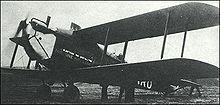
Designed by de Havilland
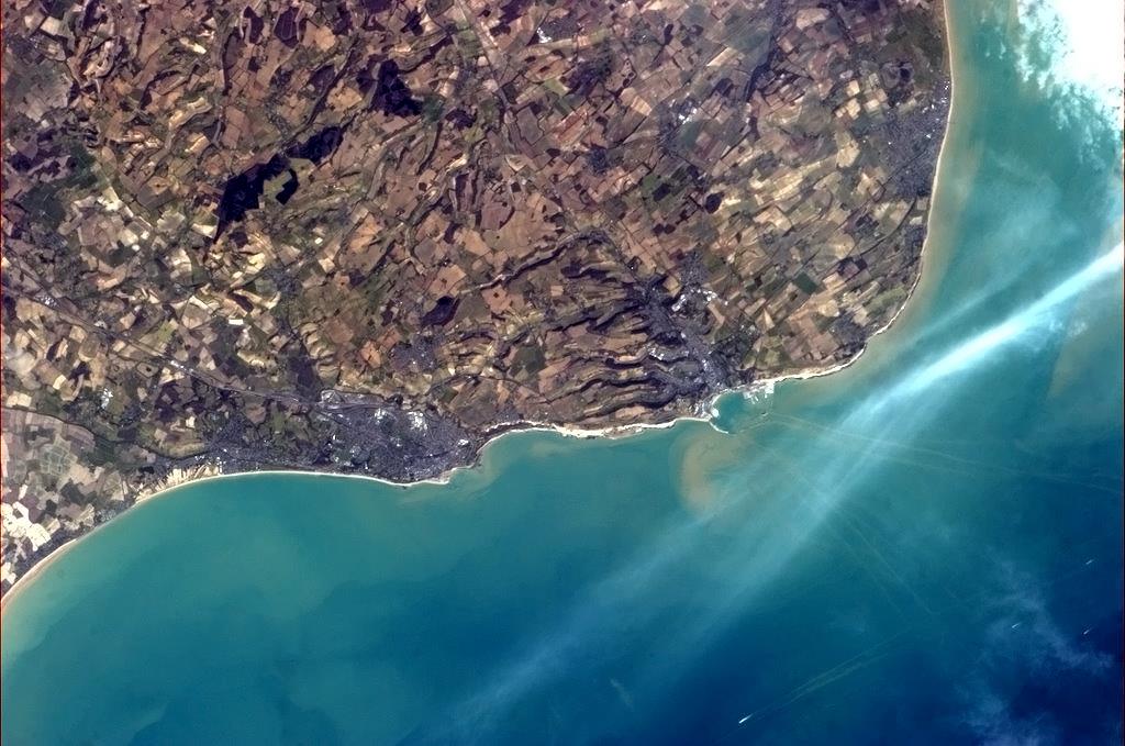
This is probably going to be the most aerial shot you will ever see of Folkestone. It was taken from the International Space Station by Canadian astronaught Chris Hadfield, who was in charge up there at the time.
Note how you can see the tracks made by the ferries going into Dover Harbour (and right past Folkestone Harbour). Plus you can make out about four ships in the channel, they must be pretty big ones to be seen from up there! The White Cliffs certainly show up well though, don't they?

Talking about prefabs, who remembers those at Hollands Avenue? This great shot of them was sent to me by Jan Pedersen. Thanks Jan!
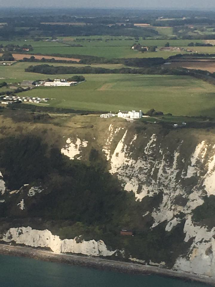
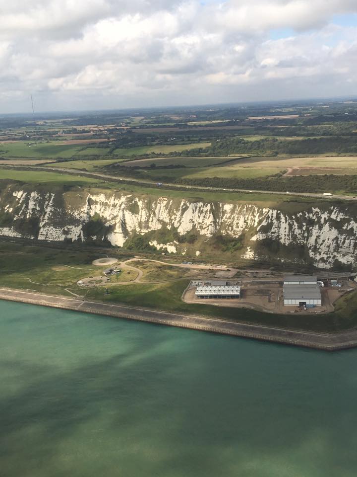
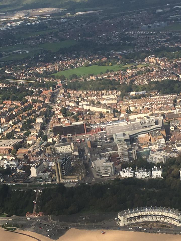
In September 2017 I was fortunate enough to spot the following aerial photographs on Facebook. Among them, they show the seafront just before they start building the housing. The photographer Paul-emma Burton has kindly given me permission to put them here, and has promised to go up again after the buildings are completed so we will have then and now views.
These two show the Duke of York's Royal Military School in Dover. In this location since 1909, the boarding school is now co-ed and open to military & non-military students age 11-18. Find out more at http://www.doyrms.com/
The West beach in 2017. The Rotunda and everything else cleared away, and a pedestrial boardwalk built. The shadows give an idea of the housing that will be built on the site.
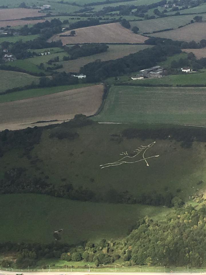
The white horse on the Etchinghill Escarpment. Looking spruced up and absolutely fine!
Samphire Hoe, an new area made from the contents pulled out when drilling out the Channel Tunnel. It has been developed into a nature reserve. A place now well worth a visit. To find out more: http://www.samphirehoe.com/uk/samphire-hoe/place/
Here is our town of Folkestone, showing Marine Crescent and the Cliff Lifts in the foreground, both dating from the late 1800's, I fear they will soon be dwarfed behind sky-scraping condominiums. At the time this photo was taken, the lifts were ground to a halt, needing a new braking system and funds to pay for it.
Folkestone Harbour, looking pretty desolate with no ferries and few fishing boats. You can now walk across the harbour viaduct as no trains run there any more.
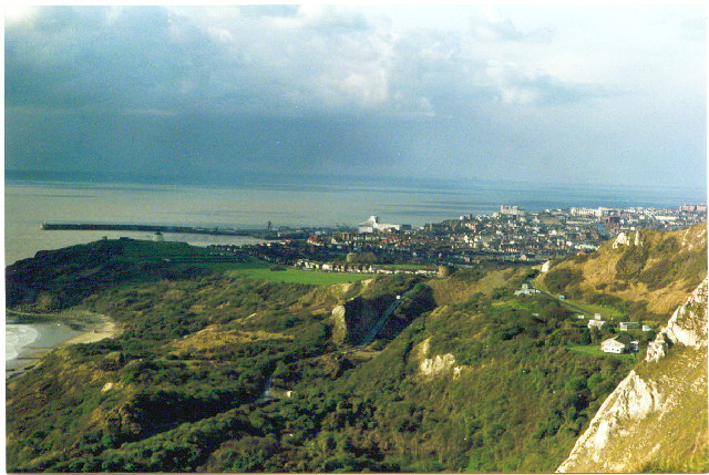
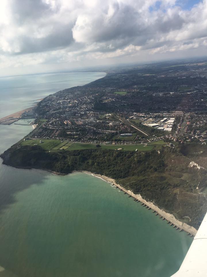
The Warren, East Cliff and across the town.
Hawkinge
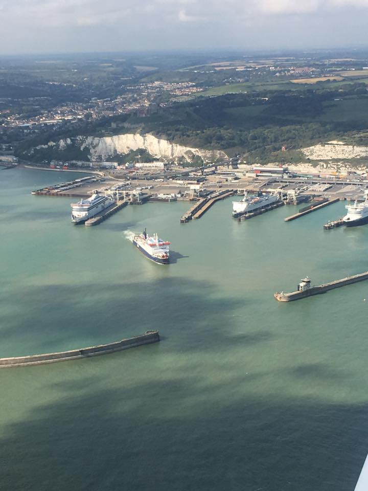
Port of Dover, how I wish we still had ships docking in Folkestone. Will never happen again though.
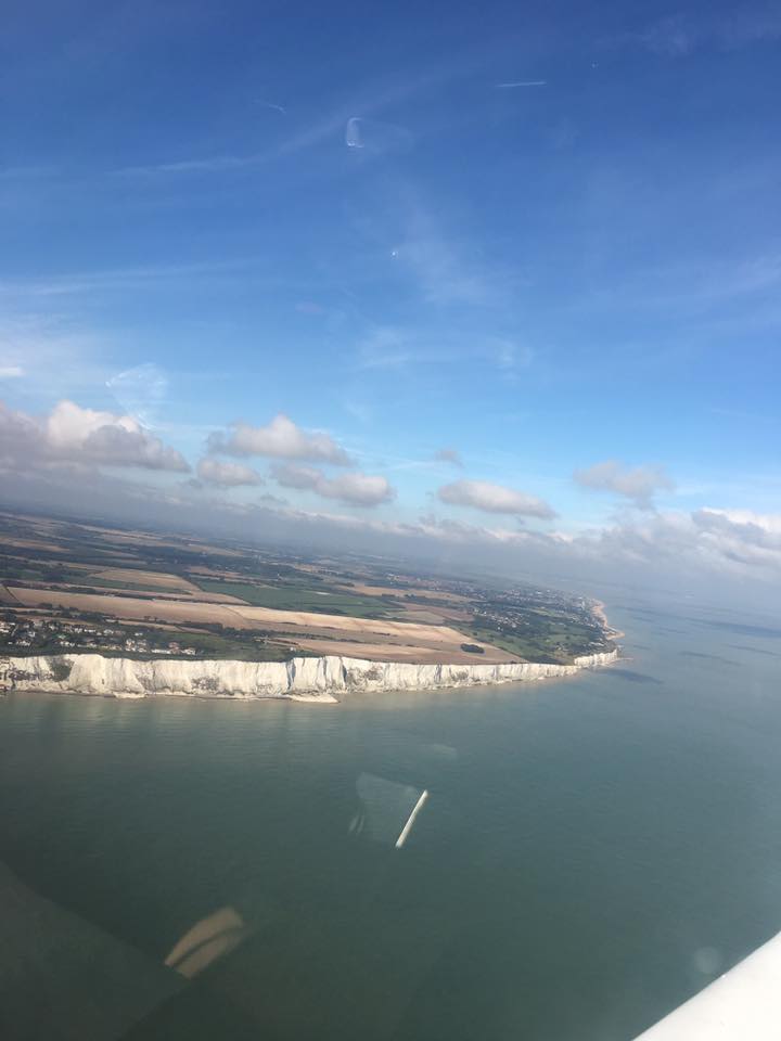
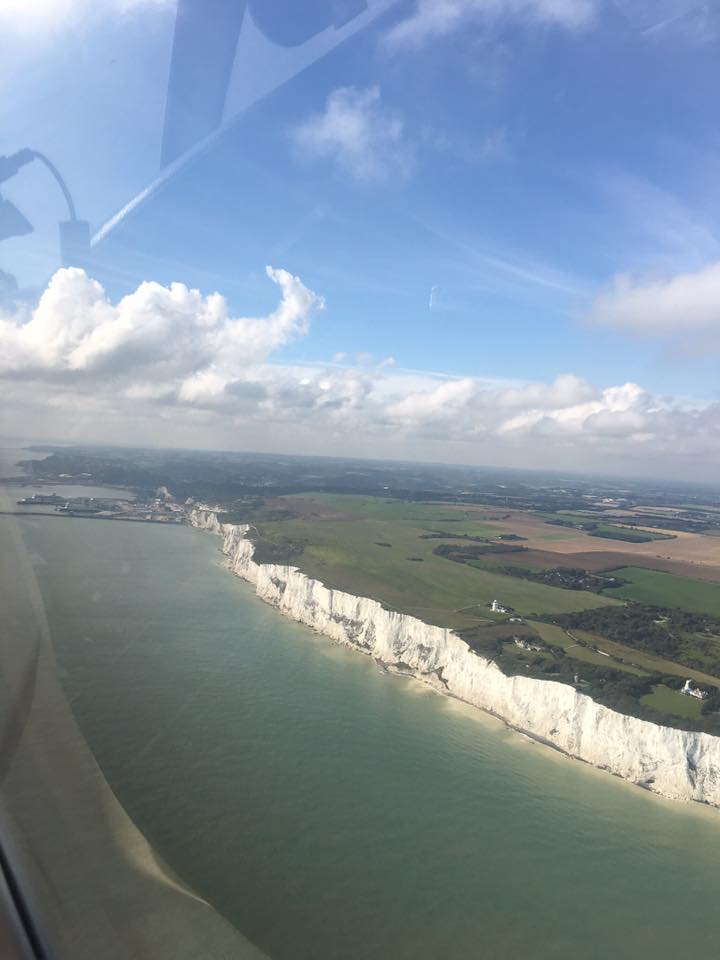
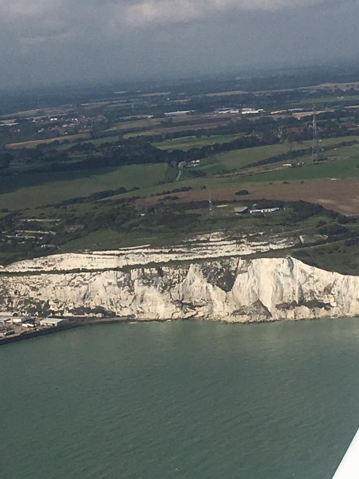
No mistaking the White Cliffs of Dover
Thank you Paul-emma for allowing us to see your fabulous collection.
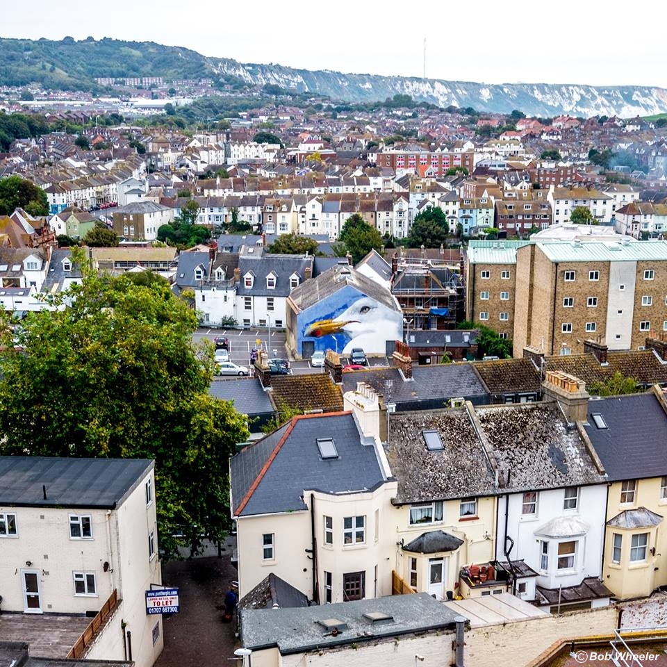
I am very grateful to Bob Wheeler for this one he took recently in 2018. What a fabulous view of Folkestone you can get from the Asda car park! Your eye is immediately drawn to the painting of the seagull by Leigh Mulley, I have seen this in person, and know it is in the Lidl car park, but I wasn't sure what was inside the building it is painted on. Graham Thorne kindly reminded me it is the auditorium of what used to be the Savoy Cinema on Grace Hill. Fantastic shot - thank you Bob!

I bought this card when I was there in 2014. I believe that is a catamaran moored beside the pier, I went across to France once on one of those, not sure if it's the same one though.
Alan Taylor sent me this one to show me where Turnpike Cottage was located on Canterbury Road, can you see it? It's on the left at the far corner, this is where they once stopped you to pay a toll, not in my lifetime though. However, I am old enough to remember having to pay to go along the Lower Sandgate Road.
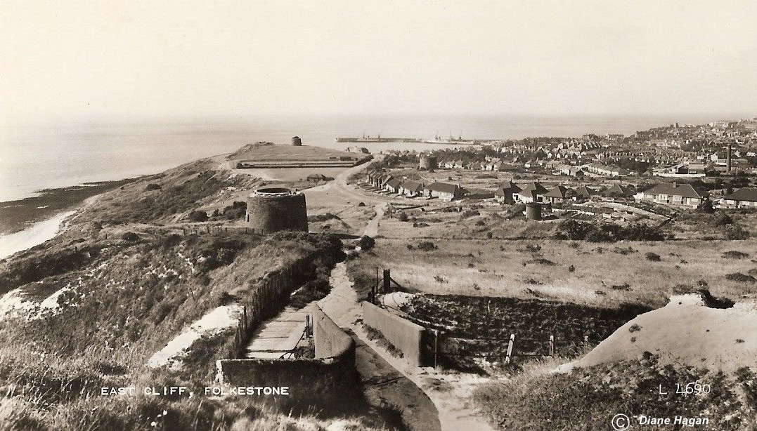
Sent to me by Diane Hagan, this is a beautiful view across the East Cliff. I believe the Martello Tower in the foreground is now a private residence. The one in the distance, which used to be in the middle of a golf course, was once used by the Council as an interpretive centre, but I believe it stands empty and is not being cared for any more. Shame.

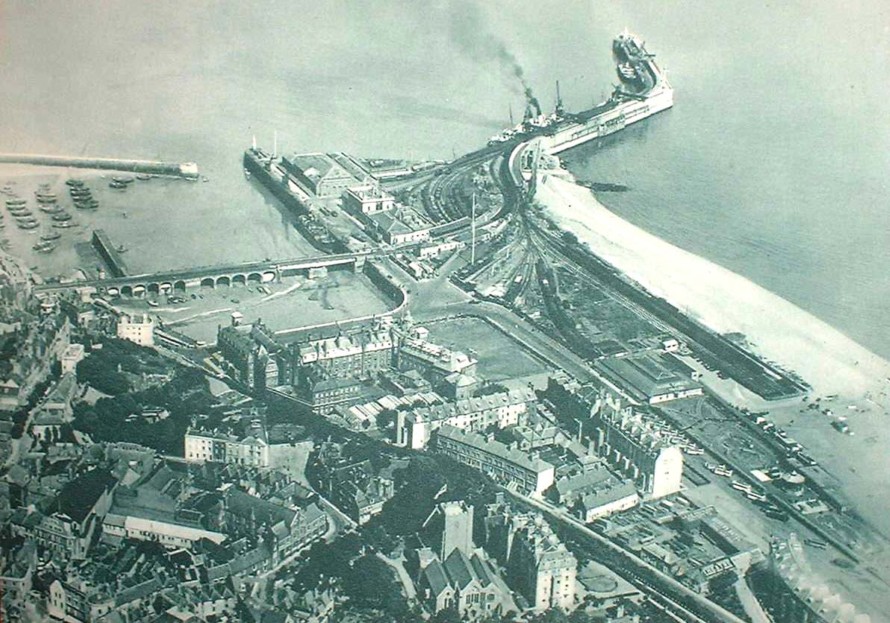
Not a lot remains from this picture. The East Head, the swing bridge and viaduct across the harbour, without the rail lines, The London & Paris, now Gillespie's, and maybe a few other small buildings.
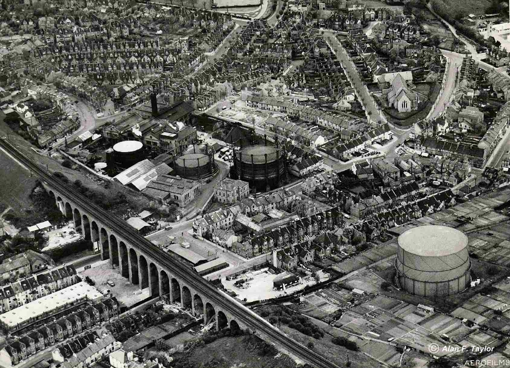
Another one supplied by Alan Taylor, just look at the detail in this! Standing out the most is the Gas Works, and how lovely to look at the viaduct from above.
Another great view of the harbour and town, as you can see, the Royal Pavilion was still there, and doesn't the Harbour Master's house stand out! How they could be considering demolishing it I don't know, it's part of Folkestone's landscape. Oh please don't let them destroy this whole area with high rise ugly buildings, after which we won't be able to see the sea or the harbour no matter where we stand!
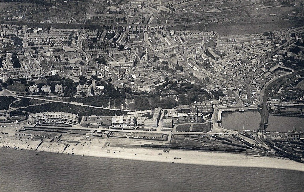
The Harbour & town from the opposite angle. I believe this one dates from the 50's or 60's.


I mentioned above that I was envious of whoever lived in the place that included that round room because of the view, and I found the building in 2014, as you can see, they have really made the most of the view from up there, look at all those windows! I couldn't show it from the same angle because I can't fly, instead it was taken from Priory Gardens.

Another one from 2014, this time taken from the Burstin at night. Again, what really stands out is the Harbour Master's house.
Again, nothing left from this except the London & Paris Hotel building and the East Head. The viaduct across the harbour is there, but no trains on it any more. No big ships either. All the other buildings you can see have been demolished.
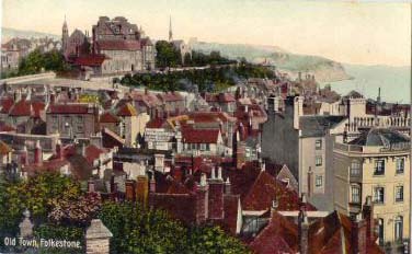
This part of Folkestone was referred to as the Old Town for many years, because this was where Folkestone started, at the Harbour and moved out from there. I was surprised to see a billboard for Freeman Hardy & Willis, so looked them up to see the history of the company. This is what I found: The shoe retailer was established in 1875 and was named after three employees of the company, one of whom was Alfred Freeman, a Russian shoe maker who resided in St Pancras, London. For many years, there was a branch in nearly every town in the United Kingdom. In 1929 the company was acquired by Sears. Its subsidiary, the Leicester-based British Shoe Corporation, went on to own the Trueform, Curtess, Dolcis, Manfield, Saxone, and Lilley & Skinner brands. The name was also simplified to Freeman Hardy Willis in order to have bolder lettering on shopfronts. During the early 1960s the paper bags used to wrap the shoes were imprinted with the FHW letters and the legend For Happy Walking.
Sale of company
In the early 1990s the British Shoe Corporation converted approximately half of the 540 Freeman Hardy Willis branches into Hush Puppies shops and sold the remainder to Stephen Hinchliffe, an entrepreneur from Sheffield. After only a year, Hinchliffe's business empire collapsed. He was subsequently jailed after it was found that he bribed bank officials to obtain loans to buy the company. After providing "Shoes For All The Family" since 1875, Freeman Hardy Willis was no more by 1996. After closure, 44 former FHW branches were sold to Stead & Simpson.
British Shoe Corporation itself closed in 1998.
I remember Freeman, Hardy & Willis well, and have bought many shoes from them.
1948
1951
1924
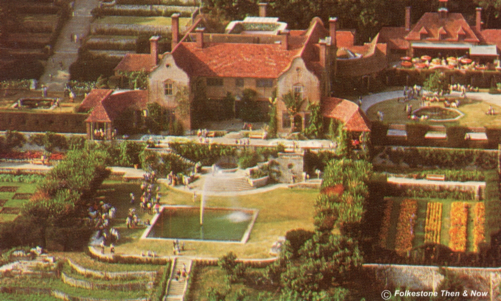
This is the mansion at Port Lympne, home of the Safari Park. The grounds were landscaped by architect Sir Herbert Baker for Sir Philip Sassoon during World War I. and it was bought by John Aspinall in 1973. Royalty and many other famous people have stayed at the mansion at the centre of the park. The rooms are lavishly decorated and the landscaped gardens have views of Romney Marsh.
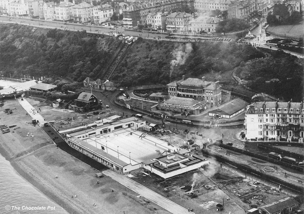
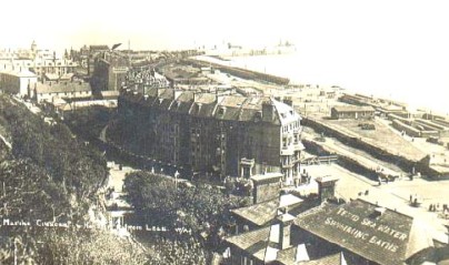
This is an interesting one sent to me by the owners of The Chocolate Pot which opened a couple of years ago at the top of the Old High Street. Now long gone. Anyway, this is a good view of the outdoor Swimming Pool, and the Indoor one which was located inside the Marina behind it - or possibly it was still being called The Bathing Establishment at this time, I am not sure. Next door to the Bathing Establishment I see the Chalet where they used to show The Follies. I wouldn't swear to it, but I think the building to the left of the swimming pool was the Rowing Club. Only thing left in the lower part of this picture is Marine Crescent on the far right, and the lifts of course, but as I type this in 2018 they are not working, they are needing a new braking system, and have no funds for it. As you can see, the War memorial is in place, but the buildings behind it are still residential, and the eyesore that is No. 1 The Leas has not yet been erected.
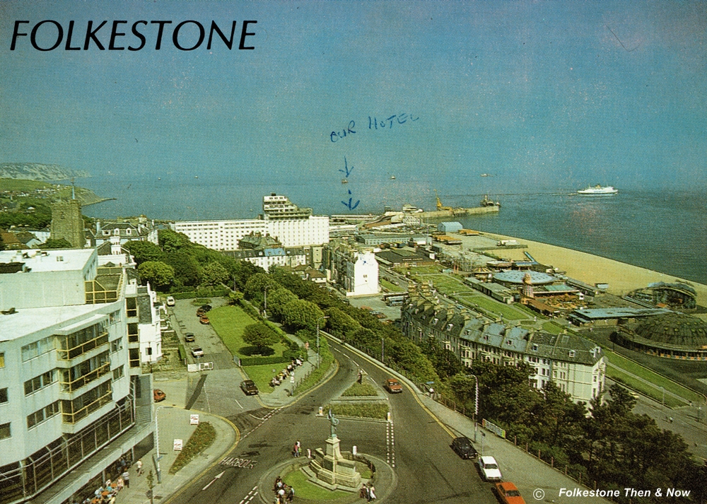
I usually clean up my cards before putting them up, but decided to leave this one as I found it very funny. It says "Our Hotel" and first points to a ship out at sea, then another arrow points to the overpass that passengers used to walk across to get to their ship. There is only one hotel right there, and they missed it! LOL!

Another one of the viaduct taken from the Central Hotel.

Three little girls and their mothers posing while walking down the steps from the Leas Shelter, the forerunner of the Leas Cliff Hall. Maybe they are on their way to have a ride on the Switchback Railway, located near the Victoria Pier.
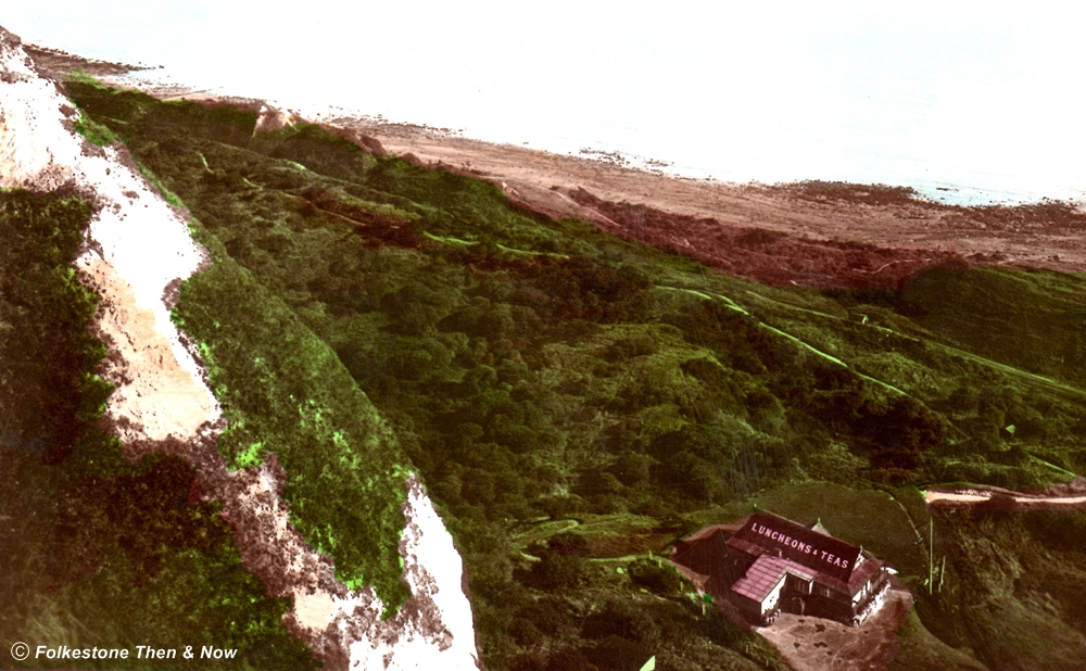
A hand coloured card of the Warren and Tea Chalet. You can still have a cup of tea and a bun there, and can get there by car.
Now I do feel this card must have been sent by a vet, because he says on the back "Where Terramycin Animal Formula for Mastitis is manufactured". He's not wrong, Terramycin was considered to be a wonder drug in 1955, and was manufactured by Pfizer in Folkestone. You can watch a video produced by Pathe News showing it being made HERE
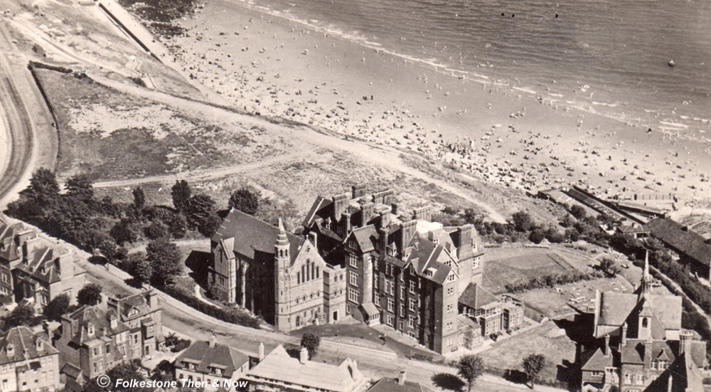
A bird's eye view of the St. Andrews flats on The Durlocks. However, when this was taken, it was the WTA Guesthouse. Before that it was a nursing home. The building immediately this side of it used to be the chapel belonging to the nursing home, but I don't know if it is still in use for religious services. Can anyone tell me please? To the right is St. Stephen's Church, which is still very much in use.

If you have your own memories of Folkestone, be sure to share them with us in the Guestbook below
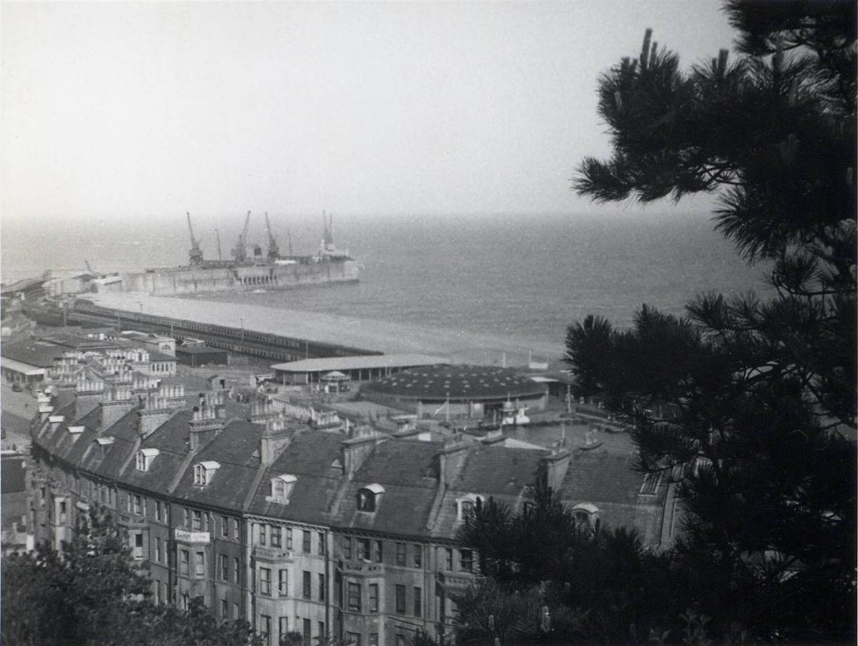
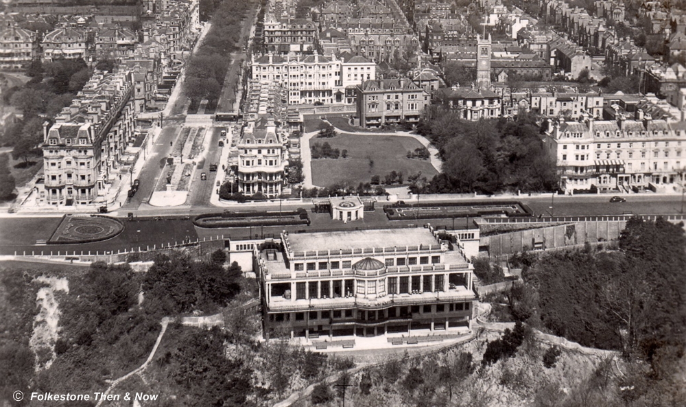
Taken in the 50's or 60's, you can make out the Leas Cliff Hall in the foreground.